
0
0
No products in the cart.
Return To Shop
Shopping cart (0)
Subtotal: ₹0.00
Free shipping across Assam. & India
Assam is blessed with unmatched picnic spots & places..
In this blog post, we bring you;
– 10 Best Picnic Spots or Places in Lower Assam,
– 10 Scenic Picnic Spots or Places in Central Assam
and
– 10 Popular Picnic Spots or Places in Upper Assam.
From the vast, sandy banks of the mighty Brahmaputra to the misty heights of the Barail Range to its lush green tea gardens, the state is dotted with locations that seem almost tailor-made for a day of relaxation.
During the winter months (November to February), families and travelers flock to the outdoors to enjoy the pleasant weather.
If you are searching for the Best Picnic Spots in Assam, this guide provides everything you need – from deep-forest retreats to majestic waterfalls to scenic river banks to historical landmarks.
So, here are our Top 50 Picnic Places in Assam categorised by region.
Best Picnic Spots or Places in Lower Assam
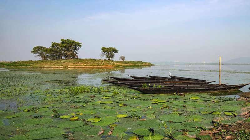
1. Chandubi Lake
Formed by the massive 1897 earthquake, Chandubi Lake is a stunning natural lagoon at the foot of the Garo Hills, about 64 km from Guwahati. It is the perfect escape for those seeking a mix of adventure, culture, and tranquility.
Why It’s a Top Picnic Spot
-
Unique Scenery: Relax by calm waters surrounded by deep forests and tea gardens. The lake is famous for its “underwater forest”—submerged tree trunks visible through the clear water.
-
Boating & Exploration: You can hire traditional rowing boats to navigate the lagoon. It’s an ideal way to see the natural landscape up close.
-
Birdwatching: During the winter months, the lake becomes a sanctuary for various migratory birds, making it a paradise for photographers.
-
Local Culture: If you visit in early January, you can experience the Chandubi Festival, featuring ethnic Rabha cuisine, traditional dances, and local handicrafts.
How to Get There
-
Route: Drive from Guwahati toward the Airport, reach Mirza, and take a left turn toward Loharghat. The final stretch through the Borduar Tea Estate is scenic but narrow.
-
Travel Time: Expect a 1.5 to 2.5-hour drive depending on city traffic.
-
Transportation: It is highly recommended to hire a private taxi for the full day. While public “Trekkers” run from Mirza to the lake, they are difficult to find for the return journey in the late afternoon.
Essential Travel Tips
-
The Best Season: Plan your trip between November and February. The weather is crisp, the water is at its clearest, and the migratory birds are most active.
-
Mobile Connectivity: Be prepared for very weak or no signal at the lake. Download your offline maps and music before leaving Guwahati to ensure you don’t lose your way.
-
Timing Your Return: It is best to leave the lake by 4:30 PM. The forest road leading back to Mirza is poorly lit and lonely; driving in daylight is much safer and allows you to spot any occasional wildlife.
-
Fuel and Supplies: Ensure you have a full tank of petrol and plenty of drinking water. Mirza is the last reliable stop for fuel and snacks before you enter the rural forest stretch.
-
Eco-Responsibility: Chandubi is a delicate ecosystem. Please carry your own trash bags and avoid using single-use plastics to help keep this natural treasure pristine.
2. Bogamati
Located in the Baksa district at the mouth of the Barnadi River, Bogamati is a stunning rocky valley sitting right on the Indo-Bhutan border.
Its name, meaning “White Soil” in Assamese, comes from the vast deposits of white sand and stones that line the riverbank. This newly discovered gem, inaugurated just a few years ago, has quickly become one of Assam’s most popular destinations for both relaxation and adventure.
Why It’s a Top Picnic Spot
Panoramic Himalayan Views: The spot offers a breathtaking, unobstructed view of the Bhutan Hills, providing a dramatic backdrop for a day out.
River Adventure: The Barnadi River is a hub for water sports. You can engage in white-water rafting, zip-lining across the river, or even water zorbing.
The Golden Buddha Statue: A short, scenic trek leads to a 25-foot tall Golden Buddha statue on a nearby hill. Built as a symbol of peace between India and Bhutan, it offers a serene spot for reflection and photography.
Crossing into Bhutan: Depending on local border regulations, visitors can sometimes cross a small bridge or shallow part of the river to experience local Bhutanese delicacies at the nearby border posts.
How to Get There
Route: From Guwahati, head toward Baihata Chariali and continue through Goreswar to reach the Bogamati area. The roads are generally well-maintained and pass through lush tea gardens and betel nut plantations.
Travel Time: The 91 km journey typically takes 2.5 to 3 hours from Guwahati.
Transportation: Private vehicles or hired SUVs are highly recommended. While you can take a bus to Tamulpur or Goreswar, you will still need to hire a local taxi to reach the actual picnic site at the foothills.
Essential Travel Tips
The Best Season: Visit between November and February. This is the peak picnic and rafting season when the water levels are ideal and the weather is pleasantly cool.
Mobile Connectivity: Like many border areas, network coverage can be unreliable or switch to international roaming (Bhutan). It is wise to inform family of your location before reaching the hills.
Timing Your Return: The Bhutan entry gate and several local checkpoints typically close by 4:30 PM. It is best to wrap up your picnic and start the drive back before sunset to navigate the rural roads safely.
Wildlife Caution: Bogamati is part of an elephant corridor. While the main picnic areas are safe during the day, avoid wandering into the deep forest or staying past dusk, as wild elephants are common in this region.
Eco-Responsibility: The area is managed by the Dawraijhar Eco-Tourism Society. To preserve the “White River” charm, ensure you pack all your plastic waste and leftovers.
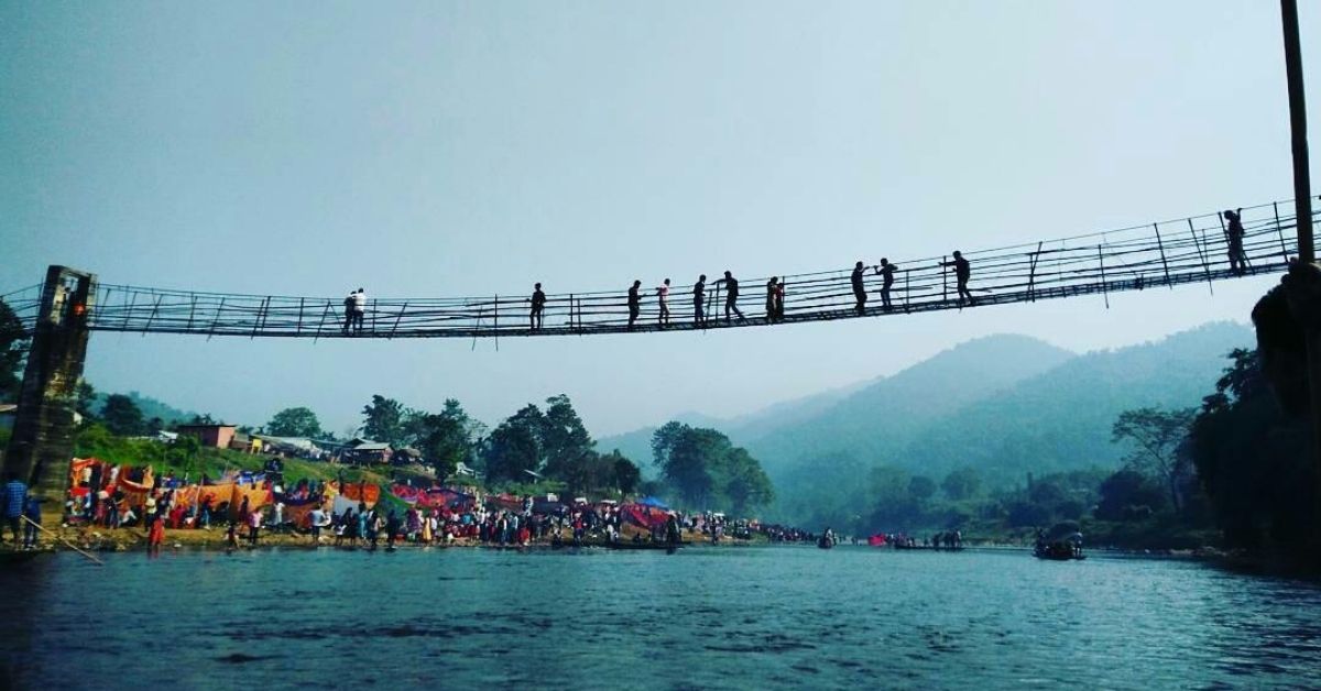
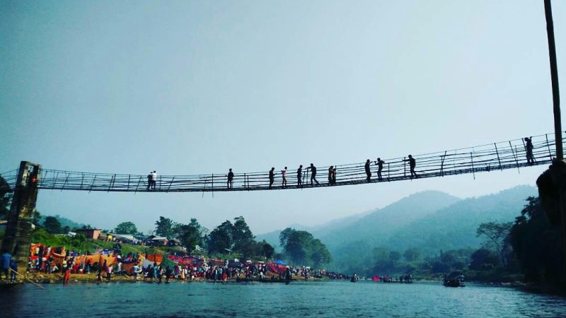
3. Hahim
Tucked away in the Boko region of Kamrup district, Hahim is a picturesque getaway situated at the foothills of the Meghalaya border. Located approximately 70 km from Guwahati, it is a hidden paradise known for its crystal-clear river streams, rolling green hillocks, and raw, untouched landscapes. It serves as a vital cultural junction for the local Rabha and Garo communities and is the perfect destination for those looking to escape the more commercialized tourist spots.
Why It’s a Top Picnic Spot
Shallow Natural Streams: The river at Hahim is known for being shallow and remarkably clear, making it safe and enjoyable for kids to play in and for families to set up their picnic mats right by the water.
Dramatic Rocky Terrain: The riverbed is filled with large, smooth boulders and surrounded by dense forests, creating a ruggedly beautiful backdrop for photography and nature walks.
Hahim-Aradonga Hanging Bridge: A major attraction nearby is the suspension bridge connecting Assam and Meghalaya. Walking across it offers a panoramic view of the valley and the winding river below.
Proximity to Waterfalls: For those who enjoy light trekking, the nearby Malangkona and Soloka Dare (Baroigaon) waterfalls are accessible from here, offering a more adventurous extension to your picnic day.
How to Get There
Route: From Guwahati, take NH 17 toward Boko. Once you reach Boko town, take the left turn at the main junction toward the hills. The road from Boko to Hahim is a scenic 18 km stretch that winds through rural villages and forests.
Travel Time: The journey typically takes 2 to 2.5 hours from Guwahati.
Transportation: Private cars or motorcycles are the most convenient. While you can take a bus to Boko from Adabari or Jalukbari, you will need to hire a local auto-rickshaw or taxi to cover the remaining distance to the picnic spot.
Essential Travel Tips
The Best Season: Plan your visit between November and February. During this time, the weather is cool and the river water is calm and clear. In the monsoon, the current can become dangerously fast and the roads quite muddy.
Mobile Connectivity: Expect intermittent or no signal as you approach the hills. It is highly recommended to inform your family of your plans beforehand and download any necessary navigation maps for offline use.
Timing Your Return: It is best to start your return journey by 4:00 PM. The stretch between Hahim and Boko is sparsely populated and can get very dark, making navigation difficult for those unfamiliar with the area.
Supplies & Parking: While there is a small local market (Hahim Bazaar) for basics like tea and snacks, it is best to carry your own picnic supplies and water. Most designated areas charge a small parking fee of approximately ₹200 per vehicle.
Eco-Responsibility: Hahim is a pristine area that lacks a formal waste management system. Please be a responsible traveler—carry your own trash bags and ensure you leave no plastic or food waste behind to protect this delicate border ecosystem.
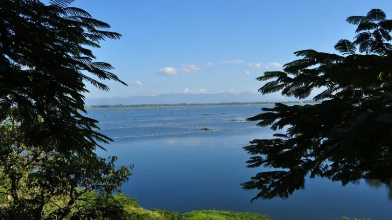
4. Deepor Beel
Deepor Beel is a permanent freshwater lake and one of the largest and most significant “Beels” (wetlands) in the Brahmaputra valley.
Recognized as a Ramsar Site and an Important Bird Area, it is a vital ecological hub located on the southwestern edge of Guwahati city. For travelers, it offers a serene escape where the city’s bustle fades into the sounds of nature.
Why It’s a Top Picnic Spot
Birdwatcher’s Haven: The wetland is home to over 200 species of birds, including rare migratory guests like the Greater Adjutant Stork and Siberian Crane during winter.
Stunning Sunsets: The beel provides a breathtaking panoramic vista of the vast water body against the backdrop of the Rani and Garbhanga Reserved Forests.
Aquatic Life & Flora: You can observe a variety of aquatic plants, including water lilies and water hyacinths, which create a vibrant green carpet across the lake.
Eco-Tourism & Photography: The area around is perfect for nature photography and peaceful lakeside walks, offering a raw, untouched feel despite its proximity to the city.
How to Get There
Route: Located just 18 km from the Guwahati city center, you can reach it by heading toward the Jalukbari bypass and taking the road toward the LGBI Airport. There is a clearly marked turnoff toward the wetland.
Travel Time: Depending on your location in Guwahati, the drive takes approximately 30 to 45 minutes.
Transportation: Since it is within the metropolitan area, you can easily reach it via private car, hired taxi, or even app-based ride services (Uber/Ola). Local city buses also ply toward Azara, from where a short auto-ride will take you to the viewing areas.
Essential Travel Tips
The Best Season: Visit between November and February. This is when the water levels are manageable and thousands of migratory birds settle in for the winter.
Mobile Connectivity: Signal strength is generally good throughout the area since it is close to the city, though it may fluctuate slightly near the forested edges.
Timing Your Return: While the area is safe, it is best to leave shortly after sunset. The road can be quite dark, and the area is known as an active corridor for wild elephants moving from the nearby hills.
Fuel and Supplies: Unlike more remote spots, there are plenty of small shops and eateries along the main road leading to the Beel. However, for a proper picnic, it is best to carry your own food and water.
Eco-Responsibility: As a protected Ramsar site, littering is strictly prohibited. Noise levels should be kept to a minimum to avoid disturbing the wildlife, and use of plastic should be avoided entirely.
5. Pobitora Wildlife Sanctuary

Often referred to as “Mini Kaziranga,” Pobitora Wildlife Sanctuary is located in the Morigaon district, approximately 45–50 km from Guwahati.
It is world-famous for having the highest density of One-Horned Rhinoceroses in the world, making it a premier destination for wildlife enthusiasts and families looking for a unique outdoor experience.
Why It’s a Top Picnic Spot
Iconic Wildlife Sightings: You can witness the Great Indian Rhinoceros from a very close range. The sanctuary is also home to wild buffalos, leopards, and wild boars.
Birding Paradise: During the winter months, the sanctuary’s wetlands, such as Haduk Beel, host over 2,000 migratory birds, offering fantastic opportunities for nature photography.
Adventure Safaris: Visitors can explore the grasslands through organized Jeep Safaris or Elephant Safaris, providing different perspectives of the landscape.
Riverside Charm: The areas near the Brahmaputra banks and the iconic Haduk Hanging Bridge offer beautiful, open settings perfect for a peaceful outdoor meal and relaxation.
How to Get There
Route: From Guwahati, head toward Narangi and continue toward Chandrapur. The drive is incredibly scenic as it follows the bank of the Brahmaputra River through the historic village of Mayong.
Travel Time: The journey typically takes 1 to 1.5 hours from the Guwahati city center.
Transportation: Private cars or hired taxis are the most convenient options. While local buses run to Mayong from Adabari or Jalukbari, they are infrequent and may not align well with the sanctuary’s safari timings.
Essential Travel Tips
The Best Season: Plan your visit between November and March. The sanctuary typically closes during the monsoon season (May to September) due to regional flooding.
Safari Timings: Early morning slots (6:30 AM – 9:00 AM) are generally best for animal sightings. Afternoon safaris usually run until 3:30 PM.
Mobile Connectivity: Network coverage in the area is generally good compared to more remote forest spots, though data speeds may fluctuate once you are deep inside the sanctuary.
Supplies and Safety: There are several eco-resorts near the entrance where you can find clean restrooms and food. For safety, always stay with a certified guide and avoid venturing into the grasslands on foot.
Eco-Responsibility: As this is a protected wildlife zone, loud music and plastic littering are strictly prohibited. It is essential to keep the environment quiet and clean to avoid disturbing the animals.
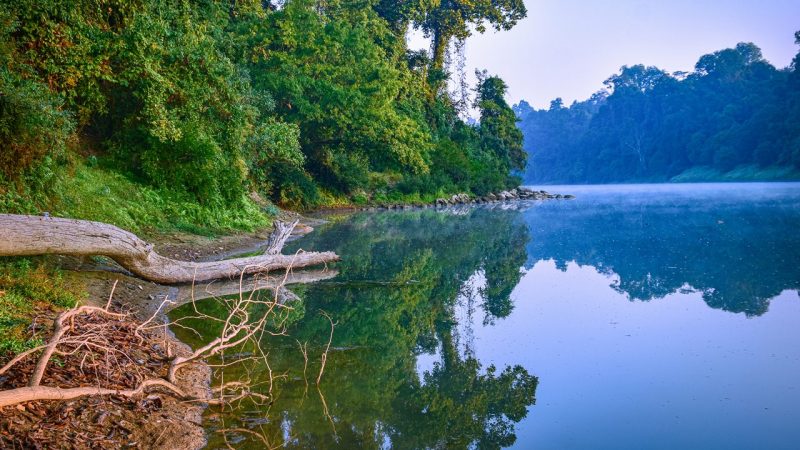
6. Kulsi River (Ukiam)
Located on the border of Assam and Meghalaya in the Kamrup district, Ukiam is a breathtaking destination where three rivers – the Kulsi, Srigaon, and Dhara – meet.
It is widely regarded as one of the most beautiful riverside spots near Guwahati, characterized by its emerald-green waters, massive granite boulders, and the backdrop of the Khasi Hills.
Why It’s a Top Picnic Spot
The River Confluence: The point where the three rivers merge creates a wide, tranquil pool of clear water that is perfect for photography and relaxing by the bank.
Adventure & Hiking: The surrounding hills and riverbed offer great opportunities for light trekking and exploring the rocky terrain.
Hanging Bridge: A long, rustic suspension bridge spans the river, providing a thrilling walk and a bird’s-eye view of the crystal-clear water and the local fishermen below.
River Dolphin Spotting: The Kulsi River is one of the few places in the world where you can spot the rare Ganges River Dolphin (locally known as Xihu). While they are more common slightly downstream, they are the pride of this river system.
How to Get There
Route: From Guwahati, take NH 17 towards Chaygaon. Once you reach the Chaygaon market junction, take a left turn and drive straight for about 25–30 km toward the hills. The road passes through beautiful rural landscapes and betel nut groves.
Travel Time: The 75 km journey usually takes 2 to 3 hours from Guwahati.
Transportation: A private vehicle or a hired SUV is the best way to travel. While you can take a bus to Chaygaon, finding reliable local transport from Chaygaon to the interior of Ukiam is difficult, especially for the return trip.
Essential Travel Tips
The Best Season: Visit between November and February. During this period, the water remains a stunning turquoise green. In the monsoon, the rivers swell and the water becomes muddy, making it unsafe for picnicking.
Mobile Connectivity: Expect very poor to no signal once you leave Chaygaon and head toward the hills. Ensure you have your logistics sorted before entering the Ukiam zone.
Timing Your Return: It is highly recommended to start your return journey by 4:00 PM. The road back to Chaygaon is narrow and can be difficult to navigate in the dark due to a lack of streetlights.
Supplies & Parking: Local communities often collect a small entry/maintenance fee (approx. ₹200–₹300) for picnic groups. There are very few shops at the site, so carry all your food, water, and charcoal/fuel.
Eco-Responsibility: The Kulsi River is a vital habitat for endangered dolphins. Please avoid dumping any waste or washing dishes/clothes in the river. Carry all plastic and non-biodegradable waste back to the city.
7. Hajo Hills
Hajo is an ancient pilgrim center located on the banks of the Brahmaputra River, approximately 24 km from Guwahati. Spread across several small hills like Manikuta, Nilachala, and Garurachala, it is a rare and sacred site where Hinduism, Islam, and Buddhism coexist in harmony, making it a spiritually rich destination for a picnic or a day of exploration.
Why It’s a Top Picnic Spot
Spiritual Diversity: You can visit the Hayagriva Madhava Temple, believed by some Buddhists to be the site of Lord Buddha’s Parinirvana, and Poa Mecca, a mosque where a “poa” (quarter) of the sanctity of Mecca is said to reside.
Panoramic Views: The climb to these hilltop shrines rewards you with sweeping views of the lush Assamese countryside and the Brahmaputra River. The sunset from the top of the hills is particularly famous.
Dedicated Picnic Areas: There are several designated open spaces near the base of the hills and along the periphery of the town where groups can gather and enjoy the outdoors.
Archaeological Marvels: Apart from the main shrines, the area features intricate stone carvings and ancient rock-cut architecture that offer a glimpse into the region’s medieval history.
How to Get There
Route: From Guwahati, cross the Saraighat Bridge and head toward Jalukbari. Follow the Hajo Road (State Highway 9) directly to the town. The road is well-paved and passes through several small rural markets.
Travel Time: The drive typically takes 45 minutes to 1 hour from Guwahati.
Transportation: Private cars, motorcycles, or hired taxis are the easiest ways to travel. Frequent city and state buses (ASTC) also run between Guwahati (Adabari or Machkhowa) and Hajo throughout the day.
Essential Travel Tips
The Best Season: Visit between October and March. The weather is cool, which is ideal for climbing the stone stairs that lead to the various hilltop temples and mosques.
Mobile Connectivity: Network coverage is generally excellent as Hajo is a well-established town close to the city.
Timing Your Return: Most visitors start heading back by 5:30 PM. While the town is safe, the shrines often close their main gates after evening prayers, and the drive back is smoother before the heavy night truck traffic begins.
Dress Code & Etiquette: Since you will be visiting active places of worship, it is important to dress modestly. You will be required to remove your footwear before entering temple and mosque premises.
Eco-Responsibility: As a site of immense religious and historical importance, please ensure you do not litter. Use the designated bins at the picnic spots and respect the silence of the shrine areas.
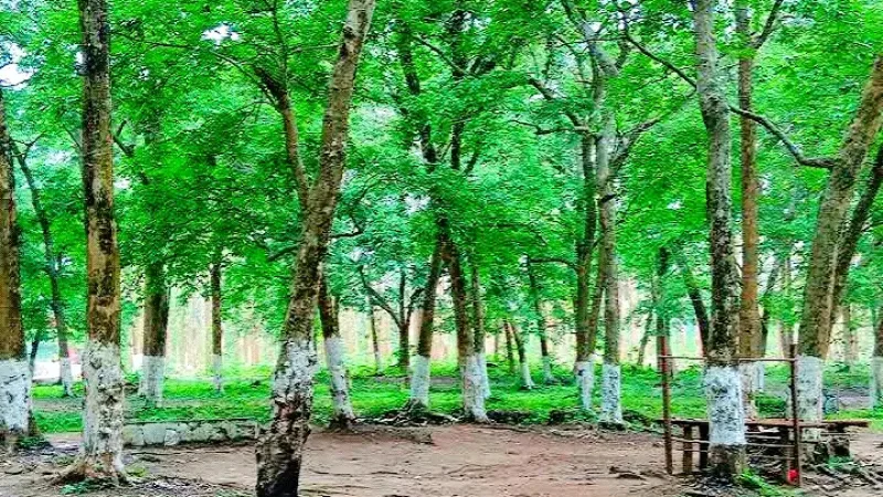
8. Garbhanga Forest Reserve
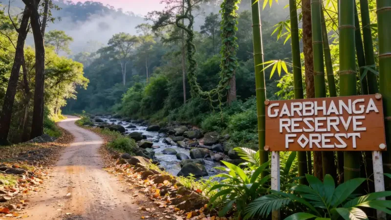
Located on the southern fringes of the city along the Assam-Meghalaya border, the Garbhanga Forest Reserve is a sprawling evergreen canopy that serves as one of Guwahati’s most vital carbon sinks. Spanning over 180 square kilometers, it is a paradise for those who prefer “off-beat” trekking and deep-forest exploration over traditional commercial picnic spots.
Why It’s a Top Picnic Spot
Hidden Waterfalls: The reserve is home to several seasonal streams and hidden waterfalls, such as the Garbhanga Waterfall, which offer a cool, refreshing setting for a secluded forest lunch.
Butterfly & Bird Haven: It is one of the richest zones in the region for biodiversity. You can spot hundreds of species of rare butterflies and birds, making it a dream for macro-photographers.
Trekking & Off-Roading: The rugged, hilly terrain is a favorite for trekkers and mountain bikers. The trails lead you through dense bamboo groves and traditional tribal hamlets.
Proximity to Wildlife: Being contiguous with the Nongkhyllem Wildlife Sanctuary in Meghalaya, it is a frequent corridor for wild elephants, deer, and occasionally clouded leopards.
How to Get There
Route: There are two main entry points from Guwahati. The most common is through Basistha Chariali. From the Basistha Temple, a forest road leads deep into the reserve. Another entry point is via Lokhra.
Travel Time: It takes about 30 to 45 minutes to reach the forest edge from the city center, but exploring the interior can take several hours.
Transportation: A 4×4 vehicle or a motorcycle is highly recommended if you plan to go deep into the forest, as the roads are unpaved and can be rocky. Standard sedans can only reach the initial forest check-posts.
Essential Travel Tips
The Best Season: Visit between October and March. Avoid the monsoon (June to September) at all costs, as the forest tracks become dangerously slippery and are prone to heavy leech activity.
Mobile Connectivity: Expect very poor to no signal once you enter the forest. Always inform someone of your expected return time before you head into the reserve.
Timing Your Return: Ensure you leave the forest by 4:00 PM. Elephant activity increases significantly after dusk, and the dense canopy makes it dark much earlier than in the city.
Permissions: While day trips to the fringes are common, deep-forest trekking sometimes requires prior permission from the Forest Department at the Basistha or Rani range offices.
Eco-Responsibility: This is a highly sensitive ecological zone. Strictly no loud music, no open campfires in dry areas, and absolutely no littering. Carry all plastic and glass bottles back to the city for disposal.
9. Madan Kamdev
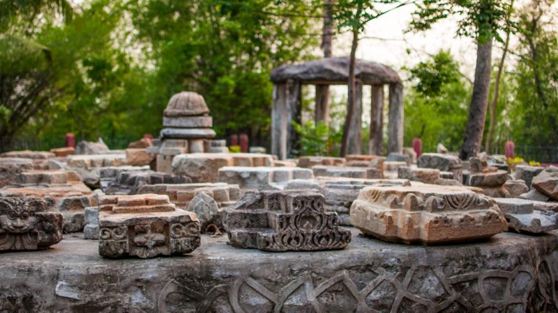
Located on the Dewan-Giri hillocks in the Kamrup district, Madan Kamdev is an archaeological treasure often referred to as the “Khajuraho of Assam.” Situated approximately 40 km from Guwahati, this 10th-to-12th-century temple complex is a remarkable remnant of the Pala Dynasty. It is a site where history, erotic art, and lush greenery converge, making it a unique destination for both heritage lovers and picnickers.
Why It’s a Top Picnic Spot
Archaeological Grandeur: The site features the ruins of over a dozen small temples scattered across the hill. The intricate stone carvings depicting deities, animals, and erotic sculptures are unlike anything else in Northeast India.
Serene Hilltop Setting: The main ruins sit atop a small hill surrounded by dense forests and a view of the nearby Madan Kunda lake. The atmosphere is quiet, breezy, and far removed from the city’s chaos.
Lush Picnic Enclaves: The foot of the hill and the areas surrounding the archaeological park offer plenty of shaded, open spaces. It is a popular spot for families to gather for a day-long outdoor meal amidst ancient ruins.
The Madan Kunda Stream: A small, perennial stream flows nearby, adding a refreshing natural element to the historical landscape.
How to Get There
Route: From Guwahati, cross the Saraighat Bridge and drive toward Baihata Chariali. Once you reach the main junction at Baihata Chariali, take a right turn and follow the signs for about 3 km to reach the temple complex.
Travel Time: The drive typically takes 1 to 1.5 hours from the Guwahati city center.
Transportation: Private cars and motorcycles are the most convenient. You can also take a bus from Adabari or Jalukbari to Baihata Chariali and then hire a local auto-rickshaw to the site.
Essential Travel Tips
The Best Season: Visit between October and March. The mild winter sun makes exploring the open-air ruins very comfortable.
Mobile Connectivity: Network coverage is good throughout the area, as it is close to the busy town of Baihata Chariali.
Timing Your Return: It is best to start your return journey by 5:00 PM. While the area is safe, the archaeological site usually closes its main gates by sunset, and the traffic at the Saraighat Bridge can get heavy in the evening.
Museum Visit: Don’t miss the small on-site museum maintained by the Archaeological Survey, which houses some of the most delicate and well-preserved sculptures found during excavations.
Eco-Responsibility: As a protected historical monument, littering near the ruins is strictly prohibited. Please use the designated picnic zones at the base of the hill and ensure all plastic waste is collected and disposed of properly.
10. Bhairabkunda

Located in the Udalguri district of Assam, Bhairabkunda is a stunning geographical marvel situated at the tri-junction of Assam, Arunachal Pradesh, and Bhutan.
It is the point where the rivers Jampani and Bhairavi merge to form the Dhansiri River. Known for its rugged Himalayan foothills and spiritual significance, it has evolved into one of the most popular picnic and eco-tourism destinations in Northeast India.
Why It’s a Top Picnic Spot
The Unique Tri-Junction: You can stand at a spot where three different regions meet. The view of the Bhutan hills rising sharply from the riverbanks provides a majestic backdrop for any outdoor gathering.
Riverside Adventure: The riverbed is wide and filled with smooth boulders, perfect for setting up a picnic spot. The crystal-clear, cold water flowing from the Himalayas is ideal for a refreshing dip or photography.
The Bhairabkunda Tourism Festival: If you visit in January, you can experience this vibrant festival which showcases the traditions, folk dances, and ethnic cuisines of the Bodo, Sharchop (Bhutanese), and Arunachali communities.
Spiritual Sites: The area is home to an ancient Shiva temple (Bhairab Kunda), from which the place gets its name. Many visitors combine their picnic with a visit to the nearby Bhutanese town of Daifam (subject to border regulations).
How to Get There
Route: From Guwahati, head toward Baihata Chariali and continue on the highway toward Mangaldai and Kharupetia. From there, take the road toward Udalguri town. Bhairabkunda is roughly 20–25 km further north from Udalguri.
Travel Time: The 135 km journey typically takes 3.5 to 4.5 hours from Guwahati.
Transportation: A private SUV or a sturdy car is highly recommended due to the distance and the rocky terrain near the river. While buses run to Udalguri, you will need to hire a local taxi to reach the actual picnic sites.
Essential Travel Tips
The Best Season: Visit between November and February. The weather is chilly and pleasant, and the river water is at its most transparent. During the monsoon, the rivers can become turbulent and unpredictable.
Mobile Connectivity: Signal strength is weak to moderate. You may occasionally pick up international roaming signals from Bhutan, so be careful with mobile data settings.
Timing Your Return: It is best to start your return journey by 3:30 PM. The drive back to Udalguri and then to Guwahati is long, and certain stretches of the road are through elephant-prone forest areas that are best navigated during daylight.
Border Protocols: If you plan to cross into the Bhutan side (Daifam), carry a valid Government ID (Aadhaar/Voter ID). Border regulations can change, so check with the local police outpost upon arrival.
Eco-Responsibility: The area is managed by local forest committees. Please respect the “No Plastic” zones. Since it is a major source of water for the plains, avoid using detergents or dumping waste directly into the river.
Best Picnic Spots or Places in Central Assam
11. Nameri National Park
Located in the foothills of the eastern Himalayas in the Sonitpur district, Nameri National Park is a sprawling preserve known for its diverse ecosystem of lush semi-evergreen forests, moist deciduous forests, and cane brakes.
Sharing its northern boundary with the Pakhui Wildlife Sanctuary of Arunachal Pradesh, it forms a massive contiguous forest belt that is a sanctuary for rare wildlife and a premier destination for eco-tourism.
Why It’s a Top Picnic and Adventure Spot
The Jia Bhoroli River: The river serves as the lifeline of the park. It is world-renowned for Golden Mahseer angling (catch-and-release) and exhilarating river rafting through gentle rapids, providing a unique vantage point to see the forest.
Birdwatching Paradise: Nameri is a critical habitat for the endangered White-winged Wood Duck. With over 300 species of birds, including various hornbills, ibises, and bee-eaters, it is widely considered one of the best birding destinations in India.
Walking Safaris: Unlike many other parks, Nameri allows visitors to explore parts of the forest on foot accompanied by a forest guard. These guided treks offer an intimate experience with the flora and smaller fauna of the park.
Diverse Wildlife: While it is a dedicated Tiger Reserve, the park is also home to large populations of wild elephants, leopards, sambar deer, and the rare Malayan Giant Squirrel.
How to Get There
Route: From Guwahati, head toward Baihata Chariali and continue on NH 15 toward Tezpur. From Tezpur, drive north toward Bhalukpong. The park entrance is located near the Potasali area.
Travel Time: The 210 km journey typically takes 4.5 to 5.5 hours from Guwahati.
Transportation: A private vehicle or hired taxi is the most practical way to reach the park. You can also take a bus from Guwahati to Tezpur and then hire a local vehicle for the remaining 35 km to the Nameri Eco Camp area.
Essential Travel Tips
The Best Season: Plan your visit between November and April. The park is at its best during these cooler months. Many activities, like rafting and trekking, are restricted during the heavy monsoon season (June to September).
Mobile Connectivity: Expect weak or inconsistent network coverage within the park area. Most eco-camps have limited connectivity, so it is best to handle any urgent digital tasks before you leave Tezpur.
Timing Your Return: If you are visiting for a day trip, you should aim to leave by 3:00 PM to avoid driving the long distance back in the dark. However, staying overnight at an eco-camp is highly recommended to fully experience the park.
Forest Entry & Activities: Entry to the park requires a permit from the forest office near the Potasali side. Rafting and trekking must be booked in advance, usually through the local eco-camps or the forest department.
Eco-Responsibility: Nameri is a highly protected area. Strictly no loud music, no littering, and no feeding of wildlife. Visitors are expected to follow the “leave no trace” principle to preserve this delicate Himalayan ecosystem.
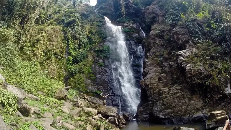
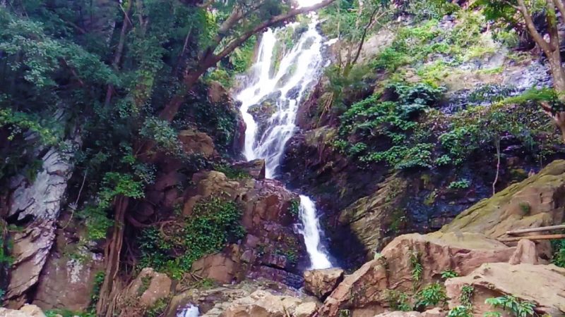
12. Kakochang Waterfall
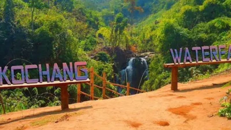
Located near the Bokakhat area in the Golaghat district, Kakochang Waterfall is one of Assam’s most magnificent natural spectacles.
Hidden amidst the lush coffee and rubber plantations of the Karbi Anglong hills, this multi-tiered waterfall cascades down into a clear pool, offering a refreshing retreat for those visiting the nearby Kaziranga National Park.
Why It’s a Top Picnic Spot
Stunning Natural Beauty: The sight of the white frothy water against the backdrop of deep green ancient forests is breathtaking. It is a premier spot for nature photography and landscape enthusiasts.
Refreshing Dip: The pool at the base of the falls is relatively shallow and clear during the dry season, making it a popular spot for visitors to enjoy a cool dip after the trek.
Trekking Adventure: Reaching the waterfall requires a light trek of about 2 km through bamboo groves and hilly terrain. The trail is an adventure in itself, offering glimpses of local flora and the rural lifestyle of the Karbi hills.
Proximity to Tea Gardens: The surrounding area is dotted with beautiful tea estates like Methoni and Difalu, allowing picnickers to combine their visit with a stroll through the iconic rolling greens of Assam.
How to Get There
Route: From Guwahati, take NH 715 towards Bokakhat. Once you reach Bokakhat, the waterfall is located about 13 km away. You will need to take a local interior road that leads toward the hills of Karbi Anglong.
Travel Time: The 230 km journey from Guwahati takes approximately 4.5 to 5 hours. Most visitors combine this with a trip to Kaziranga, as it is only about 30 minutes from the Kohora range.
Transportation: A private car or hired taxi is the best way to reach the starting point of the trek. While buses run to Bokakhat, you will need to hire a local “Trekker” or auto-rickshaw to reach the forest entrance.
Essential Travel Tips
The Best Season: Visit between October and March. During the monsoon, the trekking path becomes extremely slippery and muddy, and the waterfall can become dangerously turbulent.
Mobile Connectivity: Network signal is very weak or absent near the waterfall and along the trekking trail. Plan your meet-ups and navigation before heading into the hills.
Timing Your Return: It is highly recommended to start your trek back by 3:30 PM. The forest trail becomes dark quickly under the canopy, and the area is part of an elephant corridor, making it safer to be back on the main road before sunset.
Footwear & Gear: Wear sturdy, high-grip shoes for the trek as the rocks near the waterfall are perpetually mossy and slippery. Carry your own drinking water and snacks, as there are no shops at the falls.
Eco-Responsibility: Being located in a sensitive hilly forest zone, littering is a major concern. Please carry all plastic waste back to Bokakhat for disposal. Avoid using soap or detergents in the waterfall pool to keep the water pure.
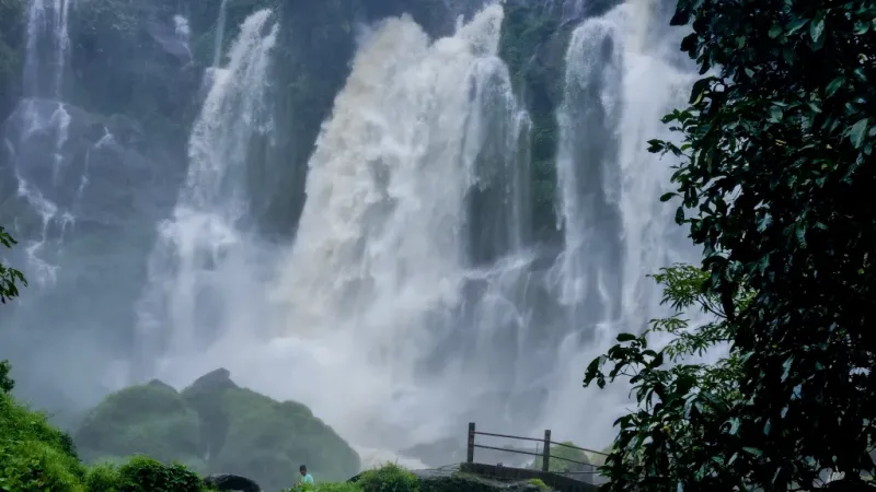
13. Panimur Waterfall
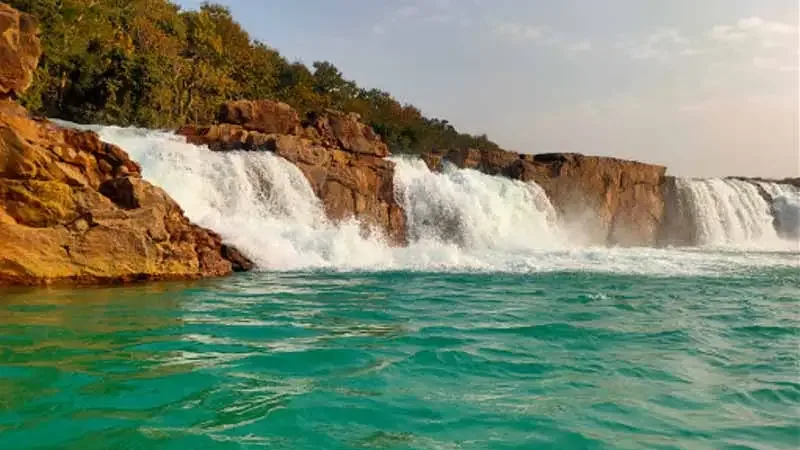
Called as “The Niagara of Assam”, it is located in the Dima Hasao district along the border of West Karbi Anglong, Panimur Waterfall is one of the most spectacular natural landmarks in Northeast India.
Formed by the mighty Kopili River as it surges over massive limestone rocks, the waterfall is famous for its wide, powerful cascades and the turquoise blue hue of its waters during the dry season. It is a site of both immense natural beauty and religious significance.
Why It’s a Top Picnic Spot
Dramatic River Landscapes: The sheer volume of water thundering over the rocky riverbed creates a misty, ethereal atmosphere. The expansive limestone formations around the falls provide unique vantage points for photography and exploring.
The “Blue Water” Phenomenon: During the winter months, the Kopili River turns a stunning shade of translucent blue, contrasting beautifully with the white froth of the falls and the surrounding greenery.
Cinematic Appeal: Its rugged beauty has made it a popular filming location for regional and national cinema, offering a “raw” wilderness feel that is rare to find elsewhere.
Spiritual Importance: Panimur is considered a holy site by the local Dimasa community and other pilgrims. During the Magh Bihu period, many people visit for a holy dip in the Kopili River.
How to Get There
Route: From Guwahati, take the road toward Nagaon and then head toward Lanka in the Hojai district. From Lanka, you will need to drive approximately 40–50 km through rural roads and forest stretches toward the Dima Hasao border to reach Panimur.
Travel Time: The 220 km journey typically takes 5 to 6 hours from Guwahati. Due to the travel time, many visitors choose to stay overnight in nearby towns like Umrangso or Haflong.
Transportation: A sturdy vehicle (SUV/High-clearance car) is strongly recommended, as the final stretch of road can be rugged and uneven. Public transport to this remote area is limited and involves changing multiple local shared taxis from Lanka.
Essential Travel Tips
The Best Season: Plan your visit between November and February. This is when the water is clear and blue. During the monsoon, the Kopili River swells dramatically, turning the water muddy and making the rocks extremely dangerous and slippery.
Mobile Connectivity: Expect very poor to no signal near the waterfall. It is a remote forest zone, so ensure your offline maps are downloaded and your travel plans are shared with someone beforehand.
Timing Your Return: It is highly recommended to start your return journey by 3:00 PM. The road back to Lanka passes through isolated forest areas where lighting is non-existent and mobile help is unavailable.
Safety Near Water: The currents of the Kopili River at Panimur are notoriously strong and unpredictable. Avoid swimming near the main falls or standing on wet, mossy rocks, as accidents are common for those who ignore safety boundaries.
Eco-Responsibility: Panimur is a pristine ecological and religious site. There is no formal waste management, so it is crucial to carry all plastic bottles, wrappers, and picnic waste back with you to the nearest town for disposal.
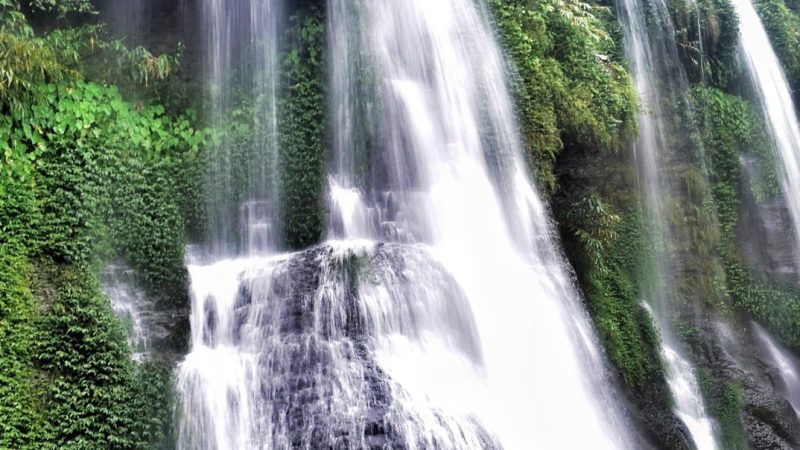
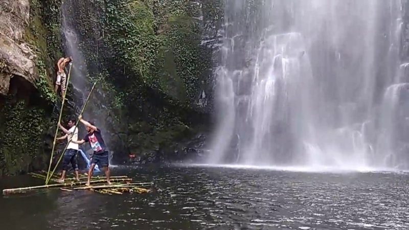
14. Champawati Kunda (Chapnalla)
Located in the Nagaon district near the town of Chapnalla, Champawati Kunda (also known as Chapnalla Falls) is a stunning three-layered waterfall situated at the foothills of the Karbi Anglong range.
Surrounded by lush tea gardens and the dense forests of the Laokhowa Wildlife Sanctuary, it is a site steeped in local folklore and natural beauty, making it one of Central Assam’s most cherished picnic spots.
Why It’s a Top Picnic Spot
The Three-Tiered Cascade: The waterfall is unique for its three distinct layers—Upper, Middle, and Lower Kunda. The lower fall is the most accessible and impressive, plunging from a height of approximately 70 meters.
Mythological Significance: Local legend says the waterfall is the petrified form of Princess Champawati, who transformed into stone to escape an unwanted union. The site is considered sacred, and a ritual bath during Maghi Saptami (January/February) is believed to bring blessings.
Tea Garden Ambience: The approach to the falls takes you through the scenic Jiajuri Tea Estate. The contrast of the manicured tea bushes against the wild, rugged hills creates a beautiful setting for a day trip.
Birdwatching & Wildlife: Being close to Laokhowa Wildlife Sanctuary, the area attracts numerous migratory birds during winter. You might also spot various butterfly species and, if lucky, smaller forest animals near the hill tracks.
How to Get There
Route: From Guwahati, follow NH 27 toward Nagaon. After reaching Nagaon town, drive about 16–20 km east toward the Kaliabor sub-division via the Nagaon-Dimapur road (NH 36/37) to reach Chapnalla.
Travel Time: The 140 km journey typically takes 3 to 3.5 hours from Guwahati.
Transportation: Private cars or SUVs are highly recommended. While the main highway is excellent, the internal road leading to the tea estate and the falls can be bumpy for small hatchbacks. Local auto-rickshaws are available from Nagaon town or Samaguri.
Essential Travel Tips
The Best Season: Visit between October and March. The weather is pleasant for the light trek required to see the upper layers. While the waterfall is most powerful in the monsoon, the paths can become extremely slippery.
Mobile Connectivity: Network coverage is moderate to good in the Chapnalla town area but tends to drop significantly as you move closer to the hills and the waterfall base.
Timing Your Return: It is best to start your return journey by 4:00 PM. The area near the tea gardens is secluded, and elephant movement from the nearby Karbi hills is common after dusk.
Trekking & Safety: To reach the middle and upper tiers, a short but steep trek is required. Wear sturdy footwear with good grip. Avoid swimming directly under the heavy flow of the main fall, especially during the rainy season.
Eco-Responsibility: The site is a mix of a sacred pilgrimage spot and a nature reserve. Strictly avoid littering plastic or food waste. Carry your own drinking water and snacks, as there are no permanent shops at the immediate waterfall site.
15. Sivakunda Waterfall
Located in the Morigaon district, Sivakunda is a breathtaking natural wonder situated within the Amsoi Hills.
Approximately 85–90 km from Guwahati, this waterfall is a seasonal marvel that gains immense popularity during the winter months for its serene environment and the dramatic rock formations surrounding the pool.
Why It’s a Top Picnic Spot
Scenic Natural Ambiance: The waterfall is nestled amidst a dense forest, providing a refreshing escape from urban life. The sight of the water cascading over massive stone slabs into a clear basin is a highlight for photographers.
Ideal for Group Outings: The area near the base of the falls offers ample space on the rocks and nearby clearings for families and large groups to set up a traditional picnic.
Exploring the Rocks: The rugged terrain around the stream invites light exploration. Many visitors enjoy navigating the large boulders that define the riverbed leading away from the main falls.
Winter Magnet: Due to its manageable distance from both Guwahati and Nagaon, it becomes a vibrant social hub during the peak picnic season in December and January.
How to Get There
Route: From Guwahati, travel along NH 27 towards Nagaon. Once you reach the Dharamtul or Amsoi area, take the interior road heading toward the Amsoi Hills. The waterfall is located a few kilometers inside from the main highway.
Travel Time: The journey typically takes 2 to 2.5 hours from the Guwahati city center.
Transportation: A private car or motorcycle is the most efficient way to reach the spot. While public buses run frequently between Guwahati and Nagaon, you would need to hire a local vehicle from the Amsoi junction to reach the waterfall site.
Essential Travel Tips
The Best Season: Plan your visit between November and February. During this time, the water flow is steady and the surrounding tracks are dry. In the peak monsoon, the area can become quite muddy and the river levels can rise unexpectedly.
Mobile Connectivity: Expect weak or intermittent signal as you move into the hilly forest area. It is wise to have your route mapped out before leaving the main highway.
Timing Your Return: It is highly recommended to start your return journey by 4:00 PM. The stretch from the falls to the highway is relatively secluded and lacks street lighting.
Supplies & Parking: While local committees often manage parking and basic facilities during the peak season, it is best to carry your own food, water, and cooking supplies. There are very few shops once you enter the forest road.
Eco-Responsibility: Being a forested area, littering is a significant concern. Please ensure you pack all plastic waste and leftovers to take back with you. Avoid using soap or detergents in the natural water pools to preserve the local ecology.
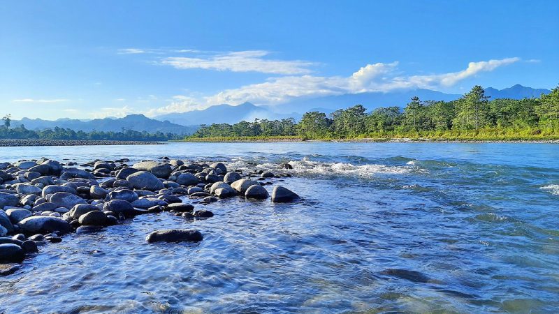
16. Bhalukpong
The Bhalukpong region, straddling the Assam-Arunachal Pradesh border along the Jia Bhoroli (Kameng) River, is a premier destination for those seeking a blend of riverside relaxation and mild adventure.
The Assam side, primarily located in the Sonitpur district, offers several sandy banks and forested spots that are particularly popular during the winter picnic season.
Why It’s a Top Picnic Spot
The Jia Bhoroli Riverfront: The wide, stony riverbed provides ample space for large groups to set up picnic camps. The sight of the turquoise water emerging from the Himalayan foothills is truly spectacular.
Adventure Hub: This area is a primary starting point for white-water rafting and angling. Even if you aren’t participating, watching the rafts navigate the river adds a lively energy to the picnic atmosphere.
No Permit Required: A major advantage of staying on the Assam side for your picnic is that you do not need an Inner Line Permit (ILP). You can enjoy the views and the mountain air without the formal paperwork required to cross deeper into Arunachal Pradesh.
Border Market Vibes: The nearby Bhalukpong market is a great place to explore local ethnic crafts, bamboo shoots, and traditional Arunachali pickles.
How to Get There
Route: From Guwahati, take NH 15 toward Tezpur. From the Kaliabor/Tezpur junction, head north toward Balipara and continue straight on the Bhalukpong Road.
Travel Time: The 240 km journey typically takes 4.5 to 5.5 hours from Guwahati. Because of the distance, many visitors combine this with an overnight stay at Nameri or Tezpur.
Transportation: Private SUVs or sturdy cars are best for the final stretch. Frequent buses and shared travelers run from Tezpur to the Bhalukpong border.
Essential Travel Tips
The Best Season: Visit between November and February. The river is calm and clear, and the weather is perfectly chilly. During the monsoon, the river becomes extremely turbulent and the banks often submerge.
Mobile Connectivity: Signal strength is moderate in the market area but becomes very weak or disappears entirely once you move down to the riverbanks.
Timing Your Return: It is highly recommended to pack up by 3:30 PM. The valley loses sunlight very early, and the road back toward Balipara passes through forest stretches where elephant movement is common after dark.
Safety Warning: The current of the Jia Bhoroli is deceptively strong and the water is ice-cold. Avoid swimming in the deeper sections, as the riverbed is uneven and can be dangerous.
Eco-Responsibility: This region is adjacent to the Nameri and Pakke Tiger Reserves. Strictly avoid loud music and ensure all plastic waste is collected and brought back to the main town for disposal.
17. Umrangso Lake
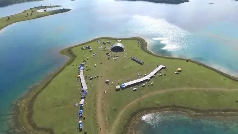
Situated in the heart of the Dima Hasao district, Umrangso Lake (often referred to as the Reservoir of the Khandong Dam) is a mesmerizing expanse of azure water surrounded by the rolling greenery of the North Cachar Hills.
This man-made lake on the Kopili River has become a premier destination for those seeking “mini-Switzerland” vibes within Assam, offering a mix of tranquil waterscapes and rugged mountain terrain.
Why It’s a Top Picnic Spot
The Turquoise Reservoir: During the winter months, the lake water takes on a brilliant turquoise blue hue, framed by the emerald hills. It is arguably one of the most photogenic landscapes in the entire Northeast.
Falcon Festival Hub: Umrangso is a migratory corridor for the Amur Falcons. Every year in November, the local community hosts the Falcon Festival, which features traditional music, ethnic food, and cultural showcases, drawing visitors from across the country.
Golf Course & Meadows: The hills surrounding the lake feature vast, open grasslands and a scenic golf course. These rolling meadows are perfect for setting up a quiet picnic while enjoying panoramic views of the water.
Boating & Sunsets: The lake offers serene boating experiences. Watching the sun set behind the blue hills while floating on the vast reservoir is a highlight for many travelers.
How to Get There
Route: From Guwahati, take NH 27 toward Nagaon and then head toward Lanka. From Lanka, you will need to take the uphill winding road toward Umrangso. The drive through the Dima Hasao hills is breathtaking but requires careful navigation.
Travel Time: The 230 km journey typically takes 5.5 to 7 hours from Guwahati. Due to the distance and the hilly terrain, it is highly recommended to plan at least a two-day trip.
Transportation: A sturdy SUV or a car with high ground clearance is best for the hilly roads. While shared taxis run from Lanka to Umrangso, a private vehicle offers the flexibility to stop at scenic viewpoints along the way.
Essential Travel Tips
The Best Season: Visit between November and February. This is when the water is at its bluest and the weather is pleasantly cold. The hills are often covered in mist during early mornings, adding to the charm.
Mobile Connectivity: Network signal is moderate in the Umrangso town area but can be very weak or non-existent near the lake banks and along the highway from Lanka.
Timing Your Return: If you are not staying overnight, you must start your return journey by 2:00 PM. Driving down the hills to the plains is best done during daylight due to sharp bends and occasional fog.
Accommodation: To fully enjoy the lake, consider staying at one of the local guest houses or eco-camps that have cropped up near the reservoir. Booking in advance is necessary during the Falcon Festival.
Eco-Responsibility: Umrangso is a pristine mountain ecosystem. Strictly no littering of plastic or glass bottles. Since the lake is a major water source and part of a hydroelectric project, ensure all waste is disposed of in the town’s designated bins.
18. Akashiganga Waterfall
Akashiganga is one of the largest and most significant waterfalls in the state. Situated along the Nagaon-Dimapur road (NH 36), it is nestled in the forested foothills of the Karbi Anglong range.
The name “Akashiganga” translates to “River from the Sky,” aptly describing the dramatic drop of the water against the backdrop of towering hills and ancient ruins.
Why It’s a Top Picnic Spot
Stunning High-Altitude Fall: The water plunges from a great height into a deep green pool below. The sheer scale of the waterfall makes it a favorite for nature lovers and landscape photographers.
Spiritual & Historical Significance: Akashiganga is a revered pilgrimage site. According to mythology, it is associated with the Sati legend (Kalika Purana), and ancient stone temple ruins from the 10th–12th centuries can be found scattered nearby, adding a sense of mystery to the forest.
Lush Forest Canopy: The surrounding area is part of a dense forest belt. The walk to the waterfall takes you through a shaded canopy of giant trees and wild ferns, offering a true “jungle” experience.
Panoramic Viewpoint: From the hilltop near the shrine, you can get a breathtaking bird’s-eye view of the Brahmaputra valley and the vast green plains of Central Assam stretching toward the horizon.
How to Get There
Route: From Guwahati, follow NH 27 to Nagaon. From Nagaon, take the road toward Doboka and continue toward Bakulia/Diphu via NH 36. The waterfall is located approximately 50 km from Nagaon town.
Travel Time: The 175 km journey typically takes 3.5 to 4.5 hours from Guwahati.
Transportation: A private car or SUV is highly recommended. While buses run to Doboka or Nagaon, you will need a private vehicle or a hired taxi to reach the specific forest entry point for Akashiganga.
Essential Travel Tips
The Best Season: Visit between November and February. During this time, the water flow is elegant and the trekking path is dry. In the monsoon (June to September), the waterfall becomes thunderous and the stone steps can become extremely slippery and dangerous.
Mobile Connectivity: Expect weak or intermittent signal once you leave the main highway and enter the forest area near the falls.
Timing Your Return: It is highly recommended to start your return journey by 3:30 PM. The area is quite secluded, and the stretch of NH 36 near the Karbi hills is known for occasional elephant crossings after dusk.
The Climb: Reaching the base of the falls involves descending (and later ascending) a long flight of stone steps. It requires a moderate level of physical fitness, so wear comfortable walking shoes with good grip.
Eco-Responsibility: As a site of both natural beauty and religious importance, please strictly avoid littering. There is no formal waste collection deep inside the forest, so carry all plastic and picnic waste back to the highway.
19. Amsoi Hills
Located in the Morigaon district on the borders of West Karbi Anglong, the Amsoi Hills are a lush, elevated forest range that serves as a vital green corridor in Central Assam.
Known for their dense canopies of Teak and Sal trees, these hills are most famous for housing the Sivakunda Waterfall, but the range itself offers a deep-forest experience that is increasingly popular with trekkers and offbeat travelers.
Why It’s a Top Picnic Spot
The Sivakunda Connection: The primary attraction is the Sivakunda Waterfall, where milky white water gushes over massive rocks into a serene pool. The surrounding riverbed is a favorite for setting up traditional wood-fire picnic kitchens.
Amsoi Tea Estate: On the way to the hills, you pass through the beautiful Amsoi Tea Estate. The rolling green slopes of the tea garden against the backdrop of the blue hills offer a classic Assamese landscape perfect for photography.
Adventure Sports: The rugged terrain of the Amsoi Hills has recently become a hub for activities like water rappelling (at the waterfall) and light trekking through the Kholakat Reserve Forest.
Tiwa Cultural Heritage: The hills are inhabited by the indigenous Tiwa (Lalung) community. Visiting the local villages offers a glimpse into their unique traditions, architecture, and the historical “Raja Mela” festivities.
How to Get There
Route: From Guwahati, travel along NH 27 towards Nagaon. Upon reaching the Dharamtul or Amsoi junction (about 70–80 km from Guwahati), take a right turn into the forest road. A 9-km winding road leads you deep into the Amsoi Hills.
Travel Time: The journey typically takes 2 to 2.5 hours from the Guwahati city center.
Transportation: A private vehicle or motorcycle is the best option. While the main highway is excellent, the internal forest road can be narrow and unpaved in some stretches, so a car with decent ground clearance is helpful.
Essential Travel Tips
The Best Season: Plan your visit between November and March. The hills are pleasantly cool, and the forest tracks are dry enough for trekking. The monsoon season makes the roads muddy and increases the risk of leeches.
Mobile Connectivity: Signal strength is weak and highly inconsistent once you enter the hilly terrain. Ensure you have offline maps or local directions sorted before leaving the highway.
Timing Your Return: It is highly recommended to start your return journey by 3:30 PM. The Amsoi Hills are an active wildlife corridor, and wild elephant movement is very common after dusk. The local “Tong Tarang” (bamboo sounds) often signals their arrival.
Supplies & Parking: There are very few shops once you head toward the hills. Carry your own drinking water, food, and fuel. A small entry fee is often collected by the local development society for parking and maintenance.
Eco-Responsibility: The area is rich in biodiversity and sacred to the local community. Strictly avoid loud music and ensure you carry all plastic waste back to the main highway for disposal.
20. Samaguri Beel
Samaguri Beel is a famous oxbow lake formed by the abandoned course of the Kolong River.
Situated about 11–15 km from Nagaon town, this wetland is a paradise for nature lovers and photographers, especially during the winter months when it transforms into a vibrant hub for avian life.
Why It’s a Top Picnic Spot
Birdwatching Excellence: The lake is a major attraction for migratory birds flying in from Siberia and other cold regions. You can frequently spot species like the Lesser Whistling Teal, Fulvous Whistling Duck, and various types of kingfishers and herons.
Boating & Leisure: Visitors can enjoy peaceful boat rides across the stationary waters of the lake. The calm environment makes it an ideal spot for those looking to escape the noise of the city and enjoy a quiet day by the water.
Scenic Landscape: The “Beel” (lake) is surrounded by lush green vegetation and local villages, providing a quintessential rural Assamese backdrop. The reflection of the winter sun on the vast water body creates stunning visuals during sunrise and sunset.
Proximity to Pokhi Tirtha: Locally known as “Pokhi Tirtha” (Pilgrimage for Birds), the area is ecologically significant and offers a great educational experience for children and wildlife enthusiasts.
How to Get There
Route: From Guwahati, take NH 27 towards Nagaon. After reaching Nagaon town, proceed towards the Samaguri area. The lake is well-connected by local roads branching off from the main highway.
Travel Time: The 135 km journey typically takes 2.5 to 3 hours from Guwahati.
Transportation: Private cars, motorcycles, or hired taxis are the best options. Since it is very close to Nagaon town, you can also take a bus to Nagaon and then hire a local auto-rickshaw or taxi to reach the lake.
Essential Travel Tips
The Best Season: Visit between November and February. This is the peak time for migratory birds. During the summer and monsoon, the bird population thins out, and the area can become quite humid.
Mobile Connectivity: Signal strength is generally good as the lake is located near major human settlements and the Nagaon-Samaguri highway.
Timing Your Return: It is best to start your return journey by 4:30 PM. While the area is safe and close to the town, the bird activity is highest during the early morning and late afternoon, and the light for photography fades quickly.
Binoculars & Cameras: If you are a birdwatcher, carrying a pair of binoculars or a camera with a good zoom lens is highly recommended, as many birds stay towards the center of the lake.
Eco-Responsibility: As a vital wetland habitat, please strictly avoid littering and do not throw food or plastic into the water. Keep noise levels to a minimum to avoid disturbing the migratory birds.
Best Picnic Spots or Places in Upper Assam
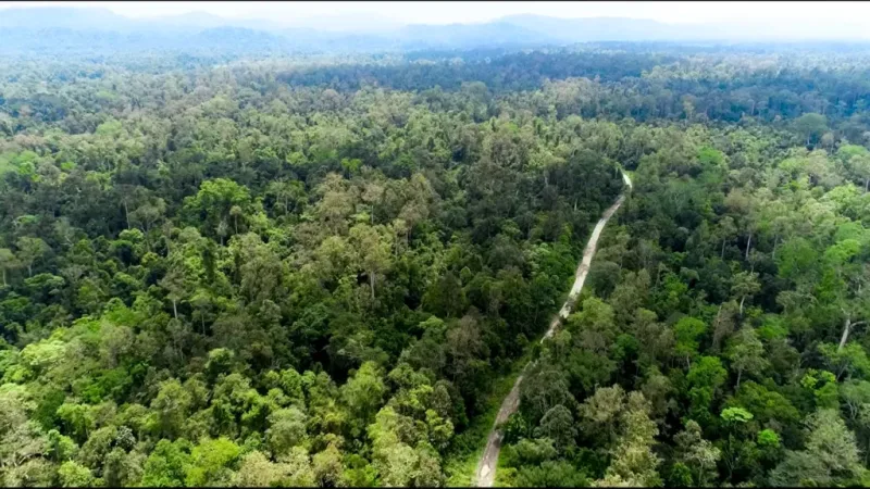
21. Jeypore Rainforest
The Jeypore Rainforest is located in Dibrugarh, and is one of the last remaining lowland evergreen rainforests in India.
This sprawling biological hotspot is part of the broader Dehing Patkai landscape and offers a glimpse into a prehistoric, untouched wilderness. It is a premier destination for serious nature enthusiasts, researchers, and those looking for an immersive jungle experience.
Why It’s a Top Wilderness Spot
Incredible Biodiversity: The rainforest is famous for harboring seven different species of wild cats, including the Clouded Leopard and the Marbled Cat. It is also a critical habitat for the Hoolock Gibbon, the only ape found in India.
Orchid and Floral Wealth: Jeypore is home to an astonishing variety of wild orchids and giant trees like the Hollong (the state tree of Assam), which tower over the dense, multi-layered canopy.
Birding Destination: For birdwatchers, this is a must-visit. You can spot the rare White-winged Wood Duck, along with various species of hornbills, trogons, and babblers that thrive in the deep, humid forest.
Offbeat Exploration: Unlike more commercialized parks, Jeypore offers a “raw” feel. The sound of the gushing Dehing River and the constant hum of cicadas create a truly primal atmosphere.
How to Get There
Route: From Guwahati, the distance is significant. You must travel east toward Dibrugarh or Naharkatia. From Dibrugarh town, Jeypore is approximately 60 km away.
Travel Time: The 450+ km journey from Guwahati takes about 9 to 10 hours by road. It is highly recommended to take a train to Dibrugarh or fly into Dibrugarh Airport and then hire a vehicle.
Transportation: A sturdy private vehicle is essential for navigating the forest periphery roads. The nearest major railhead is at Naharkatia.
Essential Travel Tips
The Best Season: Plan your visit between October and March. The forest is almost inaccessible during the monsoon due to heavy rainfall and the proliferation of leeches.
Mobile Connectivity: Expect very poor to no network signal once you enter the core forest zones. It is a remote wilderness area where digital communication is unreliable.
Timing Your Visit: Most explorations are done during early morning hours. It is best to exit the forest by 3:00 PM, as the dense canopy makes it dark very quickly, and the area is a known corridor for wild elephant herds.
Permits and Guides: Entry usually requires permission from the forest department. It is mandatory to take a local guide or a forest guard, as the terrain is dense and it is easy to lose your way.
Eco-Responsibility: This is an exceptionally sensitive ecosystem. No loud music, no plastic littering, and no trekking without authorized personnel. Be prepared for leeches—carrying salt or tobacco is a common local tip for forest treks.
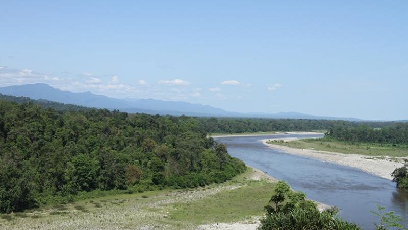
22. Bogibeel Riverside
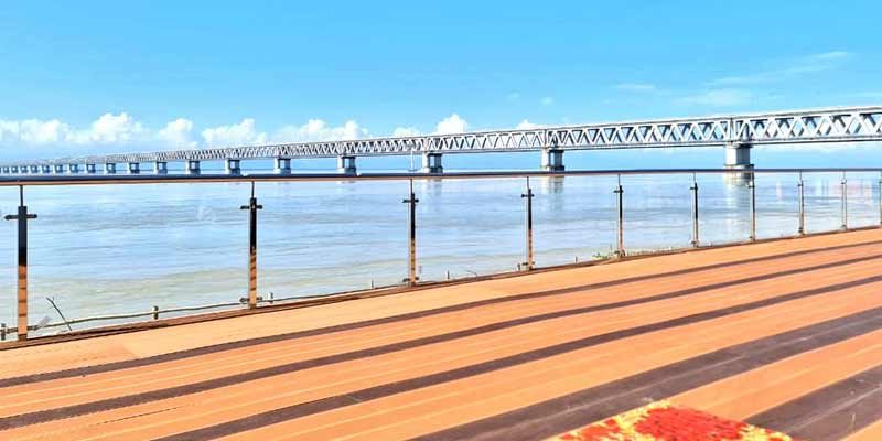
Bang in the middle of Dibrugarh and Dhemaji districts, the Bogibeel Riverside is a massive landscape defined by India’s longest rail-cum-road bridge spanning the mighty Brahmaputra.
Since its inauguration in 2018, the riverside has transformed into a premier destination for those seeking a mix of modern engineering, expansive river views, and a breezy outdoor atmosphere.
Why It’s a Top Picnic Spot
The Engineering Spectacle: The 4.94 km long bridge provides a stunning backdrop. Watching the sunset over the Brahmaputra with the bridge spanning the horizon is a highlight for photographers and tourists.
Vast Riverbanks: During the winter, the receding water levels reveal massive white sandbanks. These stretches are perfect for large-scale picnics, bonfire gatherings, and even off-roading on the firm sand.
River Cruises & Boating: Small local boats and luxury cruises operate in this area, offering a unique perspective of the bridge from the water. It is a popular way to spot the rare Gangetic River Dolphins that frequent these waters.
Birdwatching: The surrounding wetlands and sandbars attract numerous migratory birds during the winter, making it a great spot for casual birding.
How to Get There
Route: From Guwahati, it is a long journey toward Upper Assam. You can take NH 27 and NH 15 toward Dibrugarh. The bridge connects the south bank (Dibrugarh) to the north bank (Dhemaji).
Travel Time: The 440 km journey from Guwahati takes about 8.5 to 10 hours by road. Many visitors arrive via the Dibrugarh Airport or the Rajdhani Express to Dibrugarh and then take a short 20-minute drive to the bridge.
Transportation: Private cars are best for accessing the various “viewpoints” along the riverside. Public transport is available in the form of local buses and trekkers from Dibrugarh town.
Essential Travel Tips
The Best Season: Visit between November and February. This is the only time the sandbanks are fully exposed and the weather is pleasant. During the monsoon, the Brahmaputra is in spate, and the riverside areas become submerged and dangerous.
Mobile Connectivity: Signal strength is generally strong on both ends of the bridge and along the riverside, as it is close to major industrial hubs and Dibrugarh town.
Timing Your Visit: Arrive by 3:30 PM to catch the “Golden Hour.” The sunset here is legendary. However, it is best to head back to the main town by 6:00 PM as the riverside reaches can become very windy and dark.
Winds and Dust: The riverbanks can get extremely windy during the afternoon. It is advisable to carry a light jacket and sunglasses to protect against flying sand.
Eco-Responsibility: Because it is a popular spot, littering has become an issue. Please carry your trash bags and ensure no plastic or food waste is left on the sandbanks or thrown into the Brahmaputra.
23. Kangthilangso Waterfall
Located in the Karbi Anglong district near the town of Den Arong (formerly Howraghat), Kangthilangso Waterfall is one of Assam’s most breathtaking natural secrets.
Cascading down the rugged hills of the Karbi plateau, this multi-step waterfall is surrounded by dense, untouched tropical forests, offering a raw and serene experience that remains far from the usual tourist crowds.
Why It’s a Top Picnic Spot
Dramatic Tiered Falls: The waterfall features multiple tiers, with the main drop plunging into a wide, clear pool. The sight of the white water crashing against the dark, ancient rocks of the Karbi Hills is spectacular.
Pristine Environment: Unlike more accessible falls, Kangthilangso retains a “wild” feel. The surrounding forest is thick with bamboo and tall evergreen trees, providing a natural cooling effect even during sunny days.
Cultural Immersion: The journey to the falls takes you through traditional Karbi villages. It is an excellent opportunity to see the unique architecture of Karbi huts and experience the warm hospitality of the local hill tribes.
Photography & Trekking: The trail from the parking area to the base of the falls involves a short, scenic trek. The limestone formations and the lush green moss-covered rocks offer incredible frames for nature photographers.
How to Get There
Route: From Guwahati, follow NH 27 toward Nagaon and then continue toward Dokmoka on the way to Diphu. From Dokmoka, you will need to take a detour toward Den Arong (Howraghat). The waterfall is located about 12–15 km from the main Howraghat town.
Travel Time: The 210 km journey typically takes 4.5 to 5.5 hours from Guwahati. Most people visit this as part of a longer trip to Diphu or while traveling through Central Assam.
Transportation: A sturdy vehicle (SUV or high-clearance car) is strongly recommended, as the interior roads leading from the highway to the waterfall can be narrow and bumpy.
Essential Travel Tips
The Best Season: Visit between October and March. The water is crystal clear and the flow is manageable. During the monsoon, the waterfall becomes extremely powerful and the trekking path becomes dangerously slippery.
Mobile Connectivity: Expect very poor to no signal once you leave the main town of Howraghat and head toward the hills. It is best to inform someone of your plans before heading into the interior.
Timing Your Return: It is crucial to start your return journey by 3:00 PM. The road back to the highway passes through thick forest patches and hilly terrain where visibility drops quickly after sunset, and wild elephant movement is common.
Footwear: Wear high-grip trekking shoes or sandals. The rocks around the waterfall are perpetually wet and mossy, making them very slippery.
Eco-Responsibility: This is a pristine site managed by local Karbi communities. Strictly no littering and no loud music. Please respect the local traditions and carry all your plastic waste back to the town for disposal.
24. Bhelughat Waterfall
Hidden in the western reaches of the Karbi Anglong district, Bhelughat Waterfall (often locally referred to as Paklongkam) is widely hailed as one of the most majestic cascades in Assam.
Plummeting from a height of approximately 200–300 feet, this tiered wonder is a primary source of the Dikrutpi River and offers a rugged, untouched alternative to the more commercialized falls in neighboring states.
Why It’s a Top Picnic Spot
The waterfall serves as a dramatic centerpiece for nature lovers and social groups, combining raw adventure with a scenic riverside atmosphere.
Tiered Splendor: The water plunges over massive, ancient rock formations, creating a powerful mist and a soothing roar that can be heard long before you reach the base.
Natural Swimming Pools: The clear, cool water settles into natural basins below the falls, which are popular for a refreshing dip after the hike.
The Rainbow Effect: If you reach specific vantage points near the falls during a sunny afternoon, you can often spot rainbows forming in the cascading spray.
Vibrant Local Markets: During the peak winter season, small local stalls often spring up nearby, selling traditional Karbi crafts, ethnic clothing, and organic forest produce.
How to Get There
Route: From Guwahati, follow NH 27 to Nagaon and then continue toward the town of Dokmoka. From Dokmoka, a diversion leads about 18 km into the interior toward Chingthu Ronghang Village.
The Trek: The final approach involves a short trek of about 1 km through a forested path. The trail is well-marked but involves navigating rocky and occasionally slippery terrain.
Travel Time: The drive from Guwahati typically takes 4.5 to 5.5 hours, making it a long day trip or a comfortable weekend stopover if combined with a stay in Nagaon or Diphu.
Essential Travel Tips
The Best Season: For the most dramatic water flow, visit between June and October. For picnics and family outings, the October to February window is preferred for its pleasant weather and easier trekking conditions.
Safety First: The rocks near the waterfall are exceptionally smooth and slippery. It is highly recommended to wear high-grip adventure shoes and exercise extreme caution while climbing near the edge, as there are no safety railings.
Connectivity: Expect very weak or no mobile signal once you enter the forest route. Coordinate your group’s movement and return plans before leaving Dokmoka.
Eco-Responsibility: The site is managed by local village committees who take great care of the environment. Visitors are expected to pay a small entry and parking fee, avoid loud music, and carry all plastic waste back to the main road.
25. Dehing Patkai Rainforest (Soraipung)
Rising from the alluvial plains of the Dibrugarh and Tinsukia districts, the Soraipung range of the Dehing Patkai National Park represents the heart of India’s only lowland evergreen rainforest.
Often referred to as the “Amazon of the East,” this dense jungle is a prehistoric landscape where the canopy is so thick that sunlight struggles to reach the forest floor even at noon.
Why It’s a Top Wilderness Spot
The Dehing Patkai National Park at Soraipung offers a raw, sensory experience of a tropical wet evergreen ecosystem, far removed from typical tourist circuits.
The Seven Cat Kingdom: This is one of the few places on Earth where seven wild cat species coexist, including the Royal Bengal Tiger, Leopard, Clouded Leopard, and the rare Marbled Cat.
Primate Paradise: It serves as a vital sanctuary for the Hoolock Gibbon (India’s only ape), whose haunting calls define the morning atmosphere of the rainforest.
Giant Flora: The forest is dominated by the majestic Hollong trees, which soar to heights of 50 meters, draped in exotic orchids and thick woody climbers (lianes).
Avian Diversity: With over 300 bird species, it is a pilgrimage site for birders looking for the White-winged Wood Duck, Great Pied Hornbill, and various species of colorful broadbills.
How to Get There
Route: The Soraipung range is most easily accessed from Digboi (about 12 km away) or Tinsukia. From Guwahati, you can take a flight or train to Dibrugarh/Tinsukia and then hire a private taxi.
The Entry Point: The forest check-post at Soraipung is the gateway for trekking and birdwatching. Internal forest tracks are narrow and often muddy, requiring local expertise.
Travel Time: The 480+ km journey from Guwahati by road takes approximately 9 to 11 hours. It is best treated as a multi-day expedition rather than a quick trip.
Essential Travel Tips
The Best Season: Visit between October and March. The monsoon months (June to September) bring torrential rains that make the forest floor a breeding ground for leeches and render the tracks inaccessible.
Leech Protection: This is a true rainforest; leeches are an unavoidable part of the experience. Wear long socks, tuck in your trousers, and carry a small pouch of salt or tobacco water to deter them.
Mandatory Guides: You cannot enter the core forest zones alone. It is compulsory to hire a forest guard or an authorized local naturalist from the Soraipung range office for safety and navigation.
Connectivity & Power: Expect zero mobile signal once you go deep into the Soraipung range. It is a “digital detox” zone where you must rely entirely on your physical surroundings and guides.
Eco-Responsibility: The ecosystem is extremely fragile. Strictly avoid loud noises, bright-colored clothing (earth tones are preferred), and ensure that every piece of plastic or waste is carried back out of the park.
26. Majuli River Island
Floating on the vast waters of the Brahmaputra, Majuli is a world-renowned river island that offers a serene and culturally rich environment for an outdoor getaway.
While the entire island is a landscape of paddy fields and wetlands, specific riverside locations provide the perfect setting for a tranquil picnic combined with a glimpse into Assam’s unique heritage.
Top Picnic and Sightseeing Spots
Tengapania Often cited as the premier picnic destination on the island, Tengapania is favored for its picturesque setting on the banks of the Brahmaputra.
Golden Architecture: The site features a stunning golden structure with Ahom-style architecture, providing a beautiful backdrop for photography.
Riverside Views: Its proximity to the river makes it an ideal spot to watch the sunrise or sunset while enjoying an outdoor meal.
Easy Access: It is conveniently located for those traveling from the main towns of Majuli or via the ferry from Jorhat.
Molai Forest Reserve For nature lovers, this spot offers a more adventurous and offbeat picnic experience.
Man-Made Wonder: This lush forest was single-handedly planted by Jadav Payeng, the “Forest Man of India,” over several decades.
Wildlife and Birding: Visitors can explore the dense greenery, which has become a haven for various species of birds and local wildlife.
Quiet Retreat: It provides a much more secluded and quiet atmosphere compared to the popular religious sites on the island.
Samaguri Satra This is a cultural landmark that many visitors incorporate into their day trips for its world-famous artistic traditions.
Mask-Making Heritage: It is the primary center for traditional Assamese mask-making, where you can watch artisans create intricate mythological figures.
Cultural Immersion: While not a “traditional” riverside picnic spot, its open campus and historical significance make it a great place to spend a few hours learning about Majuli’s soul.
How to Get There
The Ferry Route: To reach Majuli, you must first reach Jorhat and then travel to Neemati Ghat. From there, government and private ferries operate regularly to Kamalabari Ghat or Auniati Ghat on the island.
Transporting Vehicles: You can take your own car or motorcycle onto the large ferries for a nominal fee, which is highly recommended for exploring different parts of the island at your own pace.
Travel Time: The ferry ride itself takes about 1 to 1.5 hours each way, depending on the river current.
Essential Planning Tips
The Best Season: The peak time for a visit is between November and March. The weather is cool and pleasant, and the water levels are stable.
Avoid the Monsoon: From June to September, the island is highly vulnerable to flooding, and ferry services can become unpredictable or hazardous.
Logistics: There are no major commercial malls or large restaurants in the interior; it is best to pack your own food and water if you plan to picnic at spots like Tengapania or the riverside.
Connectivity: While signals are generally available in the main villages, expect weak connectivity in remote forest areas or deep on the riverbanks.
27. Charaideo Maidams

Rising like earthen pyramids from the plains of the Charaideo district, the Charaideo Maidams serve as the sacred ancestral burial grounds of the Ahom kings and queens.
Often compared to the Pyramids of Egypt, these vaulted mounds represent over 600 years of the Ahom dynasty’s architectural and cultural legacy, recently earning the prestigious status of a UNESCO World Heritage Site.
Why It’s a Unique Heritage Spot
The site offers a profound sense of history and quietude, making it a sophisticated choice for those who prefer “cultural sightseeing” over a noisy picnic.
The Royal Necropolis: There are over 150 maidams in the area, though only about 30 are protected. The largest and most prominent mounds belong to the early Ahom monarchs, reflecting the evolution of their mortuary traditions.
Architectural Mastery: Each maidam consists of a central vaulted chamber (where the king was laid to rest with his belongings) covered by a hemispherical earthen mound, topped with an open octagonal pavilion called a Chow-Chali.
Serene Landscape: The entire complex is beautifully landscaped with manicured lawns and flowering trees, providing a dignified and peaceful atmosphere for a thoughtful afternoon stroll.
The Hilltop View: Situated on a small hillock, the site offers a panoramic view of the surrounding tea gardens and the distant Patkai hills, which were the original entry point of the Ahoms into Assam.
How to Get There
Route: From Guwahati, you can travel by road via NH 27 and NH 715 toward Sivasagar. Charaideo is located about 28 km east of Sivasagar town.
Travel Time: The drive from Guwahati is long—approximately 360 km, taking about 7.5 to 9 hours. Most visitors stay in Sivasagar and make a half-day trip to Charaideo.
Transportation: Private cars or hired taxis from Sivasagar are the most convenient. Local buses and shared “Magic” taxis also ply regularly between Sivasagar and Sonari (the nearest town to Charaideo).
Essential Travel Tips
The Best Season: Visit between October and March. The mild winter sun is perfect for walking through the sprawling grounds. During the summer, the open landscape can become quite hot.
Prohibited Activities: Because this is a World Heritage Site and a sacred burial ground, traditional “loud” picnics with music and wood-fire cooking are strictly prohibited within the protected complex. It is a place for quiet exploration and photography.
Mobile Connectivity: Signal strength is excellent throughout the site, as it is close to the town of Sonari and several large tea estates.
Timing: The complex is usually open from 9:00 AM to 5:00 PM. Aim to visit in the late afternoon to see the mounds illuminated by the setting sun.
Nearby Attractions: You can easily combine this visit with other Ahom-era monuments in Sivasagar, such as the Rang Ghar, Talatal Ghar, and the massive Sivasagar Sivadol.
28. Dibru-Saikhowa National Park (Guijan)
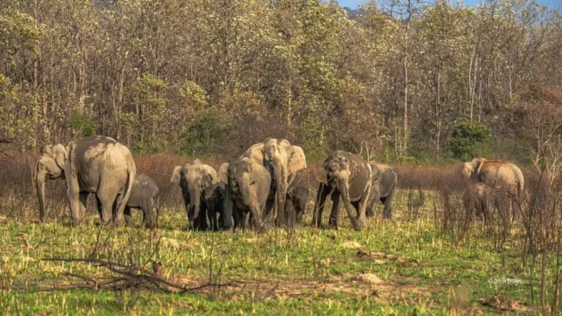
Bound by the mighty Brahmaputra and Lohit rivers to the north and the Dibru river to the south, the Dibru-Saikhowa National Park near Guijan is a mesmerizing riverine island ecosystem.
This vibrant wetland is a patchwork of moist mixed semi-evergreen forests, canebrakes, and the largest Salix swamp forest in Northeast India, offering a landscape that feels both ancient and ever-changing.
Why It’s a Top Wilderness Spot
The Guijan side serves as the primary gateway for travelers, offering a unique “water-based” safari experience that is vastly different from the jeep drives of Kaziranga.
Feral Horses: It is the only place in India where you can see wild feral horses—descendants of animals left behind by the British after World War II—roaming the sandy river islands.
Birding Sanctuary: The park is an “Important Bird Area” (IBA), home to rare species like the Jerdon’s Babbler, Marsh Babbler, and the highly endangered White-winged Wood Duck.
River Dolphin Sightings: Boat safaris along the Brahmaputra often provide sightings of the elusive Gangetic River Dolphin playing in the river channels.
The “Maguri Motapung” Connection: Located just outside the park boundary near Guijan, this large wetland is world-famous for its massive congregations of migratory ducks and geese during the winter.
How to Get There
Route: From Guwahati, travel east toward Tinsukia (via NH 27/715). From Tinsukia town, the Guijan Ghat entry point is only about 10 km away.
Travel Time: The 485 km journey from Guwahati by road takes roughly 10 to 11 hours. Most visitors prefer taking an overnight train to Tinsukia or flying into Dibrugarh Airport (40 km from Tinsukia).
Transportation: Access to the actual park is almost exclusively by boat from the entry point at Guijan. You can hire traditional country boats or larger motorized houseboats.
Essential Travel Tips
The Best Season: Visit between November and April. During the monsoon, the park is largely underwater and boat travel can be hazardous due to the river’s high volume.
Eco-Stays: Several river-facing eco-camps near the ghat offer bamboo cottage stays that provide an immersive experience right on the edge of the wilderness.
Permits and Timings: Entry permits are issued at the forest office in Guijan. Boat safaris typically operate from sunrise until 4:00 PM, as navigating the river channels after dark is not permitted.
Connectivity: Expect stable mobile signal near Guijan Ghat and Tinsukia, but once you head deep into the river channels or the island forests, the signal becomes very weak or disappears.
Eco-Responsibility: This is a delicate wetland. Strictly avoid littering in the water or on the river islands. Ensure your boatman adheres to noise regulations to avoid disturbing the birdlife and dolphins.
29. Haflong Lake

Cradled by the emerald peaks of the Dima Hasao district, Haflong Lake serves as the shimmering center of Assam’s only hill station.
This high-altitude water body is one of the most serene landscapes in the Northeast, offering a classic “misty mountain” atmosphere that feels world’s apart from the humid plains of the Brahmaputra valley.
Why It’s a Top Hillside Spot
Haflong Lake provides a rare combination of well-maintained lakeside gardens and raw mountain views, making it the heart of any visit to the “Land of the Blue Hills.”
The Hanging Bridge: A major attraction is the suspension bridge that spans a section of the lake. Walking across it provides a panoramic view of the water and the surrounding colonial-style bungalows.
Lakeside Promenade: The well-paved pathways around the lake are perfect for slow evening strolls, lined with seasonal flowers and offering plenty of benches to soak in the mountain air.
Boating and Leisure: The lake offers paddle-boating facilities, allowing you to drift across the calm waters while the surrounding Barail Range reflects on the surface.
Proximity to Haflong Town: Since the lake is centrally located, it is easy to combine a lakeside picnic with a visit to the local markets to try ethnic Dimasa cuisine or buy hand-woven Karbi and Dimasa textiles.
How to Get There
The Scenic Rail Route: The most popular way to reach Haflong from Guwahati is by the Vista Dome train or the Munsung-Maza Express. The train journey through the tunnels and over the tall viaducts of the Dima Hasao hills is an experience in itself.
By Road: You can travel via NH 27 from Guwahati toward Nagaon and then take the “Maha Sadak” (East-West Corridor) toward Haflong.
Travel Time: The rail journey takes about 5.5 to 6.5 hours, while the 270 km road trip takes roughly 7 to 8 hours due to the winding mountain climbs.
Essential Travel Tips
The Best Season: Visit between October and February for clear blue skies and chilly weather. The monsoon (June to September) makes the hills incredibly green, but landslides can occasionally disrupt road and rail travel.
Mobile Connectivity: Signal strength is generally strong throughout Haflong town and around the lake, though it may drop to 3G or 2G in the deeper valleys of the district.
Climate Note: Even in the summer, Haflong can be significantly cooler than Guwahati. It is advisable to carry a light jacket or sweater, especially for the early mornings and late evenings by the water.
Timing: The lake area is best visited during the “Golden Hour” (just before sunset) when the mist begins to settle over the water.
Nearby Adventure: If you have more time, use Haflong as a base to visit the Jatinga Bird Suicide Point (9 km away) or the historical Maibane ruins.
30. Garampani Wildlife Sanctuary
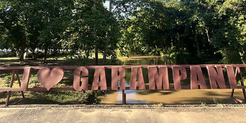
Bordering the Nambor Reserve Forest in the Karbi Anglong district, Garampani Wildlife Sanctuary is one of Assam’s oldest and most unique protected areas.
True to its name (which translates to “Hot Water”), this sanctuary is famous for its natural hot water springs and its ancient, towering forest canopy that creates a prehistoric atmosphere right off the national highway.
Why It’s a Top Forest Spot
The sanctuary serves as a vital corridor for wildlife moving between the Karbi Hills and the plains of Golaghat, offering a rare “roadside” wilderness experience.
The Hot Springs: The primary attraction is the cluster of natural sulfur springs. The water remains hot throughout the year and is believed by many to have medicinal properties for skin ailments.
Hoolock Gibbon Habitat: This is one of the most accessible places to hear and see the Hoolock Gibbon. Their loud, rhythmic calls often echo through the forest in the early morning, providing a true jungle soundtrack.
Roadside Wildlife: Because the national highway cuts through the sanctuary, it is common to spot Great Pied Hornbills, various species of macaques, and even wild elephants crossing the road near the forest fringes.
Orchid Wealth: The dense, humid environment of Garampani is a haven for epiphytic orchids that cling to the massive, moss-covered trees, blooming in vibrant colors during the spring.
How to Get There
Route: From Guwahati, follow NH 27 toward Nagaon and then take the route toward Golaghat via the Nambor-Karbi Anglong stretch. The sanctuary is located right on the side of NH 39 (now NH 129), about 25 km from Golaghat town.
Travel Time: The 280 km journey from Guwahati typically takes 6 to 7 hours by road. Many travelers stop here while on their way to Dimapur or Upper Assam.
Transportation: A private car or motorcycle is ideal. While long-distance buses between Guwahati and Dimapur pass through the sanctuary, having your own vehicle allows you to stop safely at the designated spring areas.
Essential Travel Tips
The Best Season: Visit between November and March. The weather is cool, making the hot springs particularly inviting. During the monsoon, the forest becomes extremely dense and the humidity can be quite high.
Safety Near Wildlife: Since the sanctuary is a major elephant corridor, extreme caution is required if driving through at night. Never stop your vehicle to approach or feed wild animals on the highway.
Mobile Connectivity: Expect intermittent to weak signal once you enter the thick forest stretch of the Nambor-Garampani area.
The “Sulfur” Scent: Be prepared for a distinct “rotten egg” smell near the springs; this is naturally occurring sulfur and is a sign of the spring’s volcanic origins.
Eco-Responsibility: The area near the hot springs can get crowded. Strictly avoid littering and do not use soaps or detergents if you decide to touch or bathe in the designated spring outlets, as it pollutes the natural runoff.
31. Negheriting Shiva Doul
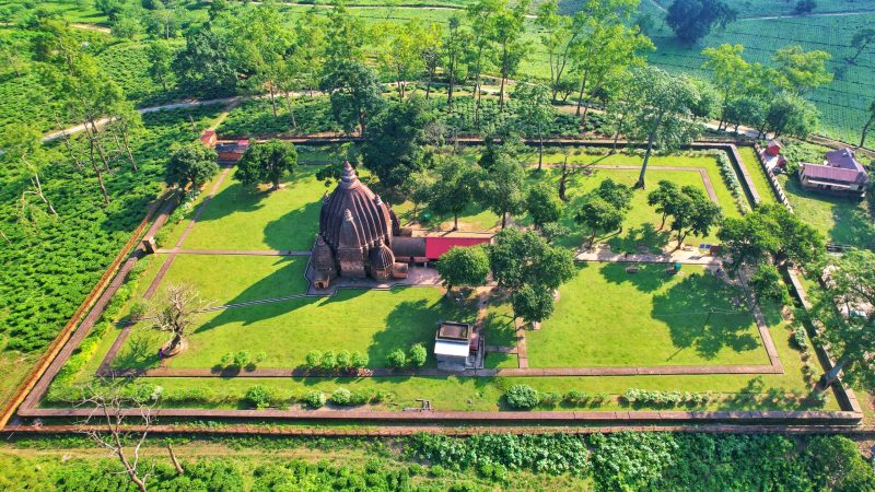
Perched atop a scenic hillock in the Golaghat district, Negheriting Shiva Doul is one of the most significant and historically layered temples in Assam.
Originally constructed by the Dimasa Kacharis in the 8th–9th century and later rebuilt by Ahom King Swargadeo Rajeswar Singha in 1765, it is a masterclass in “Panchayatana” architecture, where a central shrine is harmoniously surrounded by four subsidiary temples.
Why It’s a Unique Spiritual Spot
The temple offers a rare blend of deep antiquity and a lively, natural atmosphere that sets it apart from other Ahom-era monuments.
Architectural Layout: The main temple dedicated to Lord Shiva houses a massive Banalinga (three feet in diameter). It is flanked by four smaller temples dedicated to Lord Vishnu, Lord Ganesha, Lord Surya, and Goddess Durga—all under one unified complex.
The Famous Monkeys: The temple is famous for its large population of Rhesus macaques. These monkeys are considered permanent residents of the hillock; while they are a major attraction, they are known to be quite bold, especially if they spot food.
Origins of the Name: The name “Negheriting” is derived from a peculiar bird locally called Negheri that once inhabited the hill in large numbers.
Ancient Artistry: The exterior walls feature intricate terracotta sculptures and carvings that showcase the artistic transition from the Kachari to the Ahom periods.
How to Get There
Route: From Guwahati, follow NH 37 (now NH 715) toward Upper Assam. The temple is located at Dergaon, about 1.5 km north of the main highway.
Travel Time: The 275 km journey from Guwahati takes approximately 6 to 7 hours by road. It is a perfect stopover for those traveling between Kaziranga and Jorhat.
Transportation: Private cars are most convenient. If traveling by bus, get down at Negheriting Chariali in Dergaon, from where auto-rickshaws can take you up the hillock to the temple entrance.
Essential Travel Tips
The Best Season: Visit between October and March. The winter months offer clear views of the surrounding tea gardens and a pleasant climb up the temple stairs.
Monkey Caution: Do not carry loose food items, plastic bags, or shiny objects in your hands. The monkeys are highly opportunistic and may try to snatch items. It is best to keep your belongings inside a zipped backpack.
Dress Code: As with most ancient temples in Assam, modest attire is expected. It is recommended to wear clothes that cover your shoulders and knees.
Mobile Connectivity: Signal strength is excellent due to its proximity to the town of Dergaon and the national highway.
Maha Shivaratri: If you enjoy cultural fervor, visit during the festival of Shivaratri. However, be prepared for massive crowds, as tens of thousands of devotees congregate here for the night-long celebrations.
32. Deopahar Archaeological Site
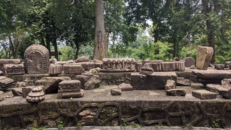
Scattered across a lush hillock in the Golaghat district, the Deopahar Archaeological Site is one of Assam’s most significant protected monuments, showcasing the artistic brilliance of the 10th and 11th centuries.
Often referred to as the “Hill of the God,” this site features the monolithic ruins of an ancient temple dedicated to Lord Shiva, characterized by intricate stone carvings that reflect the later Gupta era influence combined with local indigenous styles.
Why It’s a Top Historical Spot
The site offers a fascinating look at pre-Ahom architecture and is a haven for those who enjoy combining a light trek with historical exploration.
Intricate Stone Art: The ruins are famous for their detailed stone reliefs depicting various mythological figures, floral patterns, and animal motifs, particularly elephants and lions.
Panoramic Views: Because the ruins are situated on a hilltop, visitors are rewarded with a sweeping view of the surrounding Numaligarh tea estates and the nearby Dhansiri River valley.
Archaeological Mystery: Many of the massive stone blocks feature interlocking grooves without the use of mortar, demonstrating advanced ancient engineering techniques that have survived centuries of seismic activity.
Wildlife Proximity: The hill is part of a natural corridor for wild elephants; it is common to see evidence of their movement through the dense foliage surrounding the archaeological remains.
How to Get There
Route: From Guwahati, follow NH 27 toward Nagaon and then take NH 129 (formerly NH 39) toward Numaligarh. The site is located right near the Numaligarh Refinery intersection.
The Climb: Accessing the main ruins involves a climb of approximately 150–200 stone steps. The path is well-defined but requires a moderate level of fitness.
Travel Time: The 265 km journey from Guwahati typically takes 5.5 to 6.5 hours by road. It is a perfect half-day stop for those traveling toward Kaziranga or Jorhat.
Transportation: Private vehicles are the best option. If taking a bus, get down at the Numaligarh Tinali (three-way junction), from where the site is a short auto-rickshaw ride away.
Essential Travel Tips
The Best Season: Plan your visit between October and March. The dry winter months make the stone steps less slippery and the visibility from the hilltop much clearer.
Opening Hours: The site is generally open from 10:00 AM to 4:00 PM. It is advisable to reach by early afternoon to ensure you have enough daylight to explore the carvings and complete the descent before dusk.
Footwear: Wear sturdy walking shoes or sneakers with good grip. The ancient stone steps can be uneven and mossy, especially after a light rain.
Connectivity: Mobile signal is strong and consistent throughout the site due to its proximity to the Numaligarh township and the national highway.
Elephant Awareness: As this is an active elephant zone, avoid wandering off the designated stone paths into the thickets, and try to leave the hilltop well before sunset.
33. Diphu Hills (Botanical Garden)
Spanning approximately 40 hectares of undulating terrain, the Botanical Garden in Diphu serves as the green lungs of the Karbi Anglong district.
Managed by the State Forest Department, this sprawling park is more than just a recreational space; it is a living repository of the region’s diverse flora, featuring a massive collection of medicinal plants, rare orchids, and indigenous timber species.
Why It’s a Top Nature Spot
The garden offers a blend of botanical exploration and family-friendly leisure, making it the most popular weekend destination in the Diphu hills.
Orchid and Bamboo Wealth: The garden houses a dedicated orchidarium with over 25 varieties of wild orchids and a specialized “bambusetum” showcasing 20 different species of bamboo and cane native to Northeast India.
Medicinal Heritage: One of its most significant sections is the medicinal plant garden, which contains over 600 species of herbs and plants used in traditional Karbi and Ayurvedic healing.
Boating and Lakeside Relaxation: A central water body provides pedal-boating facilities, surrounded by well-manicured lawns that are ideal for a quiet afternoon picnic.
Cultural Replicas: Scattered throughout the park are life-sized models of traditional Karbi huts and the Jambili Athon (the decorative totem pole of the Karbis), offering visitors a glimpse into the local tribal heritage.
How to Get There
Route: The garden is located about 5 km from the main Diphu town on the road heading toward the Marat Longri Wildlife Sanctuary.
Travel Time: Diphu is approximately 250 km from Guwahati. The drive typically takes 5.5 to 6.5 hours via NH 27. Alternatively, the most efficient way is a 4-hour train journey from Guwahati to Diphu Railway Station.
Transportation: Once you reach Diphu, the garden is easily accessible via hired taxis or the ubiquitous local auto-rickshaws.
Essential Travel Tips
The Best Season: Visit between October and March for the most pleasant weather. The spring months (March-April) are particularly beautiful as many of the orchids and seasonal flowers come into full bloom.
Combine Your Visit: The Arboretum Cum Craft Centre is located nearby and is well worth a visit to see local handicrafts and additional landscaped gardens.
Operating Hours: The garden is generally open from 9:00 AM to 5:00 PM. It is advisable to reach by 2:00 PM to have enough time to explore the vast hilly sections of the park.
Footwear: Because the terrain is hilly and involves a fair amount of walking on paved and unpaved trails, comfortable walking shoes or sneakers are recommended.
Connectivity: Mobile signal strength is strong and reliable throughout the garden, as it is located on the outskirts of the district headquarters.
34. Kaliabor Tea Gardens
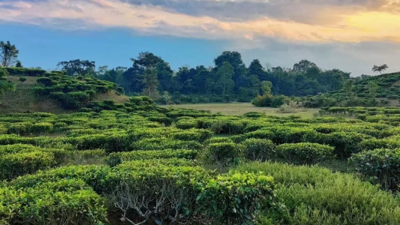
Sprawling across the rolling hills of the Nagaon district, the Kaliabor Tea Gardens offer a quintessential Assamese landscape where the emerald-green carpet of tea bushes meets the horizon.
Located near the historic town of Kaliabor, these estates are not just centers of production but are increasingly popular for “tea tourism,” providing a serene and aromatic escape from the city.
Why It’s a Top Scenic Spot
The Kaliabor region is unique because it sits at the gateway to Upper Assam, where the terrain begins to ripple into gentle undulations perfect for tea cultivation.
The “Two Leaves and a Bud” Experience: Visitors can walk through the narrow trails between the tea bushes, watching the skilled tea pluckers at work, often dressed in traditional colorful attire with bamboo baskets on their backs.
Colonial Heritage: Many of the bungalows within these estates date back to the British era, featuring high ceilings, wide verandas, and expansive lawns that evoke a sense of old-world charm.
Tea Tasting: Several estates offer guided tours where you can visit the factory to see the CTC (Crush, Tear, Curl) process and sample fresh, high-quality Assam orthodox tea.
Birding and Nature: Because the gardens are often bordered by patches of natural forest and small water bodies, they are excellent spots for spotting local bird species like the Blue-throated Barbet and various kingfishers.
How to Get There
Route: From Guwahati, follow NH 27 toward Nagaon and then continue on NH 715 toward Kaliabor. The gardens are located around the Silghat and Jakhalabandha areas.
Travel Time: The 160 km journey from Guwahati is relatively smooth and takes approximately 3.5 to 4.5 hours.
Transportation: A private car is highly recommended as it allows you to drive through the internal estate roads, which are often the most scenic parts of the journey.
Essential Travel Tips
The Best Season: Visit between October and March for pleasant weather. However, if you want to see the gardens at their lushest and witness active tea processing, the monsoon months (June to September) are best, though it will be hot and humid.
Photography: Early morning (around 7:00 AM) is the best time for photography, as the soft light filtering through the shade-giving “Siris” trees creates a magical atmosphere.
Respect the Privacy: Most tea gardens are private property. While walking along the main paths is generally fine, always ask for permission before entering deep into the plantation or visiting a private bungalow.
Connectivity: Mobile signal strength is strong and consistent throughout the Kaliabor and Jakhalabandha stretch.
Nearby Attractions: You can easily combine a visit to the tea gardens with a trip to the Hatimura Temple, the Silghat Brahmaputra Viewpoint, or the western range of Kaziranga National Park (Burapahar), which is only about 30 minutes away.
35. Kokilamukh Riverbank
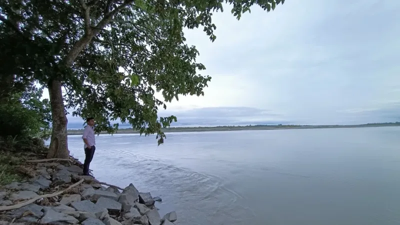
Situated on the northern fringes of Jorhat, the Kokilamukh Riverbank is a serene expanse where the Brahmaputra River creates a dramatic landscape of shifting sandbars and vast open skies.
It is primarily known to locals as a peaceful retreat for sunset viewing and winter picnics, offering a raw, uncommercialized look at the riverine life of Upper Assam.
Why It’s a Top Riverside Spot
The area is a blend of spiritual heritage and natural beauty, making it a multifaceted destination for a day trip.
Molai Forest Connection: Kokilamukh is the gateway to the famous Molai Forest, a massive man-made woodland created single-handedly by Jadav Payeng, the “Forest Man of India.”
Panoramic Sunsets: The riverbank is celebrated for its stunning sunset views. As the sun dips below the horizon, the Brahmaputra reflects a spectrum of gold and crimson, making it a favorite for photographers.
Winter Picnic Culture: During the months of December and January, the riverbank becomes a lively hub for families. People set up temporary camps on the sandy banks to cook traditional meals over open fires.
Spiritual Serenity: The nearby Shanti Ashram (also known as Assam Bangiya Saraswat Math), founded by Swami Nigamananda, provides a tranquil space for meditation and reflection just a short walk from the river.
How to Get There
Route: From Jorhat town, head north toward the Nimati Road. The riverbank is approximately 10–12 km from the city center.
Travel Time: The drive from Jorhat takes about 20 to 30 minutes. If traveling from Guwahati (300 km away), it is a 6 to 7-hour journey via NH 715.
Transportation: E-rickshaws and auto-rickshaws are readily available from Jorhat town. For those visiting the forest reserve, local boats can be hired from the ghat areas.
Essential Travel Tips
The Best Season: Visit between November and March. The receding water levels during winter reveal the vast sandy banks, and the weather is perfect for outdoor activities.
Avoid Monsoons: During the rainy season (June to September), the Brahmaputra swells significantly, often submerging the picnic areas and making the riverbank inaccessible or dangerous.
Connectivity: Mobile signal is generally stable near the main viewpoints and the ashram, but it may weaken if you venture further into the sandy “chaporis” (river islands).
Eco-Responsibility: Since the area is close to a sensitive forest reserve and a major river system, it is crucial to carry back all plastic waste and avoid loud music near the Shanti Ashram.
36. Kopili & Kalong River Sangam Point
Situated in the Morigaon district, near the historic town of Jagiroad, the Sangam Point where the Kopili and Kalong rivers meet is one of Central Assam’s most serene and geographically significant locations.
This confluence marks the union of two major tributaries before they eventually merge with the mighty Brahmaputra, creating a vast, shimmering expanse of water that is a favorite for local day-trippers.
Why It’s a Top Riverside Spot
The Sangam Point offers a tranquil escape from the noise of the national highway, providing a raw and authentic riverside experience.
The Mixing of Waters: You can often observe the distinct colors and currents of the two rivers as they merge—the Kopili, flowing from the Karbi Hills, and the Kalong, which branches off from the Brahmaputra near Nagaon.
Fishing and Boat Rides: The area is a hub for local fishermen in their traditional wooden “naos.” Visitors can often hire a local boatman for a short, peaceful ride to the exact center of the confluence.
Sunset Views: Because of the wide, unobstructed horizon over the merging waters, the Sangam Point is one of the best spots in the region for sunset photography.
Winter Picnic Hub: During the dry months, the receding water levels reveal large sandy banks (chaporis) that become popular spots for family picnics and community feasts.
How to Get There
Route: From Guwahati, follow NH 27 toward Nagaon. After passing Jagiroad, you will head toward the Nellie or Dharamtul area. The confluence is located a short drive into the interior from the main highway.
Travel Time: The 75 km journey from Guwahati takes approximately 1.5 to 2 hours, making it one of the most accessible “quick escapes” from the city.
Transportation: A private car or motorcycle is the best way to reach the exact riverside, as public transport will only drop you on the highway, leaving a considerable walk to the water’s edge.
Essential Travel Tips
The Best Season: Visit between November and February. This is when the water is calm and the sandy banks are available for sitting and picnicking.
Safety Note: During the monsoon (June to September), both the Kopili and Kalong rivers are prone to sudden rises in water levels and strong currents. Avoid boat rides and staying too close to the edge during heavy rains.
Logistics: This is an uncommercialized spot. There are no proper restaurants or shops at the confluence itself; ensure you carry your own food, water, and waste bags.
Connectivity: Mobile signal is strong and reliable due to its proximity to the national highway and the town of Jagiroad.
Nearby Attraction: You can combine this visit with a trip to the Jonbeel Beel, famous for its historic barter fair, or the Pobitora Wildlife Sanctuary, which is about 45 minutes away.
37. Digboi Hills (Ridge Point)
Perched atop the high ridges of the Tinsukia district, Ridge Point in Digboi offers the most iconic panoramic view of Asia’s oldest oil town.
This elevated vantage point provides a breathtaking 360-degree look at the industrial heritage of the “Oil City,” framed against the backdrop of the eastern Himalayas and the dense canopy of the Dehing Patkai rainforest.
Why It’s a Top Hillside Spot
Ridge Point is more than just a viewpoint; it is a location where history and nature collide, offering a unique perspective on the British-era layout of Digboi.
The Snow-Capped View: On clear winter days, the distant, snow-capped peaks of the Arunachal Himalayas are visible to the north, creating a stunning contrast with the industrial chimneys below.
Oil Field Landscape: From here, you can see the scattered oil derricks and the sprawling Digboi Refinery, which has been operational since 1901.
Sunset and Twilight: It is the premier spot in Upper Assam for watching the sunset. As night falls, the lights of the refinery and the town begin to twinkle, resembling a “carpet of stars” at the foot of the hills.
Colonial Aesthetics: The ridge is dotted with old British-style bungalows and the famous Digboi Golf Course (one of the best in the country), adding an air of colonial elegance to the rugged landscape.
How to Get There
Route: From Guwahati, travel east toward Tinsukia (via NH 37/715). Digboi is located about 35 km from Tinsukia town. Once in Digboi, follow the winding uphill roads toward the residential area of the IOCL township to reach the ridge.
Travel Time: The 490 km journey from Guwahati by road takes roughly 10 to 11 hours. Most travelers take an overnight train to Tinsukia or fly into Dibrugarh Airport (80 km from Digboi).
Transportation: A private car or a local hired taxi is the best way to navigate the steep, winding roads that lead up to the various viewpoints on the ridge.
Essential Travel Tips
The Best Season: Visit between November and March. The air is crisp and the visibility is highest during these months, offering the best chance to see the Himalayan peaks.
Photography Note: Late afternoon (around 4:00 PM) is the ideal time to arrive to catch the transition from sunset to the nighttime illumination of the refinery.
Restricted Areas: Since much of the ridge area is part of the IOCL (Indian Oil Corporation) residential township, some roads may have security checkpoints. Be prepared to show ID if requested, and respect “No Photography” signs near sensitive refinery installations.
Mobile Connectivity: Signal strength is strong and consistent as you are within the main township area.
Nearby Attraction: You must combine a trip to Ridge Point with a visit to the Digboi Oil Museum and the Digboi War Cemetery, both of which are just a few minutes’ drive away.
38. Maguri Beel
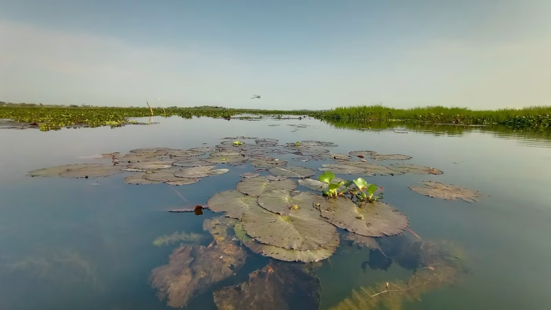
Located on the southern bank of the Brahmaputra River, just outside the Dibru-Saikhowa National Park, Maguri Beel (commonly known as Maguri-Motapung Beel) is a sprawling wetland and lake that serves as one of the most critical birding habitats in Northeast India.
This massive “beel” is famous for its shallow waters and floating grasslands, providing a sanctuary for an incredible array of migratory wildlife.
Why It’s a Top Birding Spot
Maguri Beel is a paradise for nature photographers and ornithologists, offering sightings of some of the rarest avian species in the world.
The Mandarin Duck Sensation: The beel gained global fame in recent years when the ultra-rare and vibrantly colored Mandarin Duck was sighted here after a gap of over a century in the region.
Rare Avian Residents: It is one of the best places to spot the critically endangered Baer’s Pochard, as well as the Falcated Duck, Ferruginous Duck, and the elusive Marsh Babbler.
Traditional Boat Safaris: Visitors can hire small, hand-paddled country boats to glide silently through the narrow water channels and thickets of water hyacinth, allowing for incredibly close encounters with birds.
Livelihood Landscape: The wetland is a vibrant example of man and nature coexisting; you can watch local villagers practicing traditional fishing techniques alongside congregations of thousands of migratory geese.
How to Get There
Route: From Tinsukia town, Maguri Beel is roughly 9 km away. You can reach the main entry point near the Guijan Ghat by following the Tinsukia-Guijan road.
Travel Time: The drive from Tinsukia takes about 20 to 30 minutes. If coming from Guwahati, it is a 10 to 11-hour road trip, or a 1.5-hour drive from Dibrugarh Airport.
Transportation: Auto-rickshaws and private taxis are easily available from Tinsukia. Once at the bank, you must coordinate with local boatmen for a guided tour of the wetland.
Essential Travel Tips
The Best Season: Visit between November and February for the peak migratory bird season. To catch the best activity, aim to be on a boat by sunrise (around 5:30 AM) when the birds are most active.
Connectivity: Mobile signal is generally stable near the entry points, but data speeds can be slow once you are deep inside the wetland.
Gear: Bring a good pair of binoculars and a camera with a long telephoto lens. Even for casual observers, the sheer volume of birds is spectacular.
Eco-Sensitivity: This is a fragile ecosystem. Ensure your boatman does not use a motor in sensitive areas, avoid loud noises, and strictly carry back all plastic waste to Tinsukia.
39. Margherita Tea Gardens
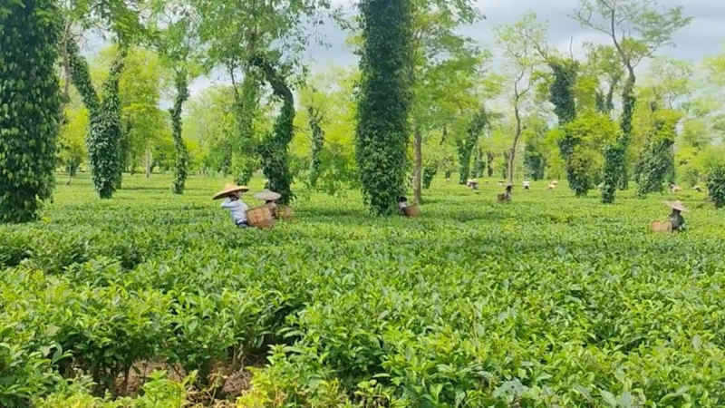
Stretching toward the foothills of the Patkai Range in the Tinsukia district, the Margherita Tea Gardens are some of the most scenic and historically significant estates in Upper Assam.
Named after the Italian Queen Margherita as a tribute to the Italian engineers who worked on the local rail lines in the 1880s, these gardens offer a unique “industrial-meets-nature” charm that is distinct from the plains of Central Assam.
Why It’s a Top Scenic Spot
The Margherita region is characterized by “hilly tea,” where the bushes are planted on steep slopes rather than flat land, creating a dramatic, textured landscape.
The Patkai Backdrop: On a clear day, the towering blue peaks of the Patkai hills (the gateway to Myanmar) provide a stunning backdrop to the vibrant green tea sections.
Colonial “Chhota Hazri” Vibes: The area is dotted with expansive British-era bungalows. Many of these heritage structures are still used by estate managers and offer a glimpse into the elite lifestyle of the 19th-century “Tea Planters.”
The Coal & Tea Connection: Margherita is unique because it is one of the few places where tea estates exist alongside historic coal mines. You can often see old steam locomotives or “Heritage Trains” that once hauled both tea and coal through these very hills.
Lush Biodiversity: Because these gardens border the Dehing Patkai National Park (the “Amazon of the East”), it is not uncommon to spot exotic butterflies, rare birds, and even the occasional capped langur near the forest fringes of the estates.
How to Get There
Route: From Guwahati, travel east toward Tinsukia (via NH 715/37). From Tinsukia, follow the road toward Digboi and continue for another 15 km to reach Margherita.
Travel Time: The 510 km journey from Guwahati by road takes roughly 11 to 12 hours. Most visitors prefer taking the overnight Ledo Intercity Express or flying into Dibrugarh Airport (95 km from Margherita).
Transportation: A private vehicle is essential for exploring the internal garden roads, which can be quite steep and winding.
Essential Travel Tips
The Best Season: Visit between October and March. The weather is crisp, and the mountain views are sharpest. If you visit in April or May, you can witness the “First Flush” picking, which produces some of the world’s most aromatic tea.
Photography: The “hilly sections” of the estates are perfect for drone photography or wide-angle shots showing the undulating rows of tea bushes.
Safety & Permits: While the main roads are public, the interior paths of the tea estates are private. Always seek permission at the estate office if you plan to do a professional photo shoot or visit a factory.
Connectivity: Mobile signal is generally good in Margherita town and the main factory areas, but it can become patchy as you move closer to the forest-clad hills near the Arunachal border.
Nearby Attraction: Don’t miss the India’s Only Coal Museum in Margherita town and the Old 20th Mile view point for a bird’s-eye view of the entire valley.
40. Namphake Village
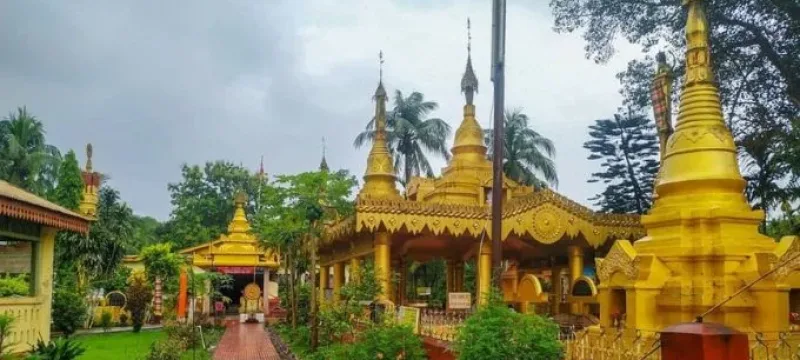
Situated on the banks of the Burhidihing River in the Dibrugarh district, Namphake Village is a living heritage site and the largest of the Tai Phake villages in Assam.
Established in 1850, it is home to a small community that migrated from Myanmar centuries ago and has meticulously preserved its distinct Tai-Buddhist identity, language, and customs.
Why It’s a Unique Cultural Destination
Namphake offers a rare glimpse into a lifestyle that feels remarkably removed from the modern world, characterized by deep discipline and spiritual devotion.
The Tai Phake Community: The villagers speak a dialect similar to Thai and still wear traditional hand-woven attire. A remarkable claim of the village is that police have never had to enter its premises; all internal disputes are traditionally settled by the village monks.
Traditional Stilt Houses: Most residents live in “Chang Ghars”—traditional bamboo houses built on stilts about six feet above the ground. These structures are designed to withstand the riverine environment and are arranged according to ancient rites.
A “Living Museum”: The village is often described by researchers as an open-air museum due to the community’s success in keeping their ancestral rituals, weaving patterns, and herbal healing methods intact despite the pressures of globalization.
Key Landmarks to Explore
The spiritual and social life of the village revolves around its historic religious complex. One of the oldest and most respected monasteries in Assam, it serves as a central meditation hub. It features a unique blend of traditional Assamese and Southeast Asian architectural styles.
Golden Statue and Sacred Tank: Inside the monastery, you will find a magnificent gilded statue of Lord Buddha and the holy Musulinda Tank, which holds great religious significance for the community.
Ashokan Pillar and Pagodas: The complex also houses a replica of the Ashokan Pillar and several white-and-gold pagodas (Cong Moo) that add to the serene, spiritual atmosphere.
Tai Phake Museum: Located near the monastery, this heritage house preserves ancient manuscripts written on handmade paper and Tai-language books, alongside historical artifacts used by the community.
How to Get There
Route: Namphake is located about 37 km from Dibrugarh and 6 km from the town of Naharkatia. From Dibrugarh town, you can take a taxi or a local bus heading toward Naharkatia.
Travel Time: The drive from Dibrugarh takes approximately 1 to 1.5 hours. If traveling from Guwahati (approx. 460 km), it is a long 10 to 11-hour journey, often broken by a stay in Jorhat or Sivasagar.
Transportation: While private cars are most convenient, local auto-rickshaws are readily available from the Naharkatia railway station or bus stand to take you directly to the village.
Essential Travel Tips
The Best Season: Visit between October and March. The Sangken festival (the Tai New Year) in mid-April is also a fantastic time to witness traditional water-splashing rituals and folk dances, though it can be quite warm.
Modest Attire: As the village is centered around a sacred monastery, visitors are expected to dress modestly (covering shoulders and knees) and remove footwear before entering the temple premises.
Traditional Cuisine: Don’t miss the chance to try authentic Tai Phake food, which typically includes “Khow boo” (steamed rice wrapped in leaves) served with boiled local vegetables and herbs.
Accommodation: While many visit as a day trip from Dibrugarh, there are local eco-tourism camps and homestays available for those who wish to experience the village’s tranquility overnight.
41. Borpukhuri: Sivasagar Lake
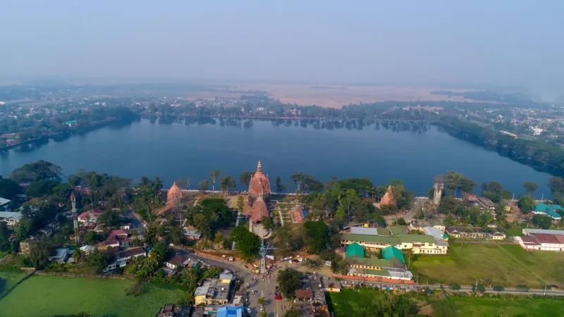
Dominating the heart of Sivasagar town, Borpukhuri (the “Great Lake”) is a massive man-made reservoir that serves as a stunning testament to the engineering and aesthetic vision of the Ahom dynasty.
Commissioned by Queen Ambika in 1734, it covers nearly 129 acres and remains one of the most iconic landmarks of Upper Assam.
Why It’s a Must-Visit Spot
Borpukhuri is the spiritual and social epicenter of Sivasagar, offering a perfect blend of history, architecture, and local life.
The Three Temples: The most striking feature of the lake is the trio of massive temples on its southern bank: the Sivadol (Temple of Shiva), Vishnudol (Temple of Vishnu), and Devidol (Temple of Durga). The golden dome (Kalash) of the Sivadol is one of the tallest in India.
Engineering Marvel: Despite being nearly 300 years old, the water level of the lake reportedly remains higher than the surrounding ground level, and it has never been known to dry up, even during the harshest summers.
Migratory Bird Haven: During the winter months, the expansive waters attract thousands of migratory birds, turning the lake into a vibrant spot for casual birdwatching right in the middle of the city.
Evening Promenade: The paved walkways around the lake are the soul of the town. In the evenings, it becomes a bustling hub for locals and tourists alike to enjoy the cool breeze and the reflection of the illuminated temples in the water.
How to Get There
Location: The lake is located in the center of Sivasagar town, making it impossible to miss.
Route: From Guwahati, follow NH 715 toward Upper Assam. Sivasagar is approximately 360 km from Guwahati.
Travel Time: The drive takes roughly 7 to 9 hours. Most travelers take an overnight bus or a train to Sivasagar Railway Station (or the nearby Joysagar station).
Transportation: Once in Sivasagar, the lake is easily accessible by foot from most hotels, or via a short e-rickshaw ride.
Essential Travel Tips
The Best Season: Visit between October and March. The weather is cool, and the migratory birds are present. For a truly unique experience, visit during Maha Shivaratri, when the entire lakefront is transformed by thousands of devotees and oil lamps.
Sunset Views: The best time to visit is about an hour before sunset. You can watch the sun go down behind the temples, followed by the evening Aarti (prayer) at Sivadol.
Street Food: The area around the lake is famous for local snacks. Don’t miss trying some hot Pithe or roasted corn while you stroll.
Connectivity: Mobile signal is excellent and high-speed 5G is available throughout the town center.
Photography: While photography is allowed around the lake and outside the temples, it is generally prohibited inside the inner sanctum of the shrines.
42. Hoollongapar Gibbon Sanctuary
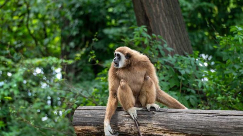
Located in the Jorhat district, the Hoollongapar Gibbon Sanctuary is an isolated pocket of tropical evergreen forest that serves as India’s only sanctuary named after a primate.
This 21-square-kilometer “green island,” surrounded by tea gardens, is the ultimate destination for wildlife enthusiasts looking to see India’s only ape—the Hoolock Gibbon.
Why It’s a Prime Wildlife Spot
Despite its small size, the sanctuary boasts an incredible density of biodiversity, particularly its unique primate population.
The Seven Primate Species: It is one of the few places on Earth where you can find seven different species of primates in one small area: the Western Hoolock Gibbon, Bengal Slow Loris, Capped Langur, Stump-tailed Macaque, Pig-tailed Macaque, Rhesus Macaque, and Assamese Macaque.
The “Singing” Gibbons: The Hoolock Gibbons are famous for their loud, rhythmic “songs” or calls, which echo through the canopy in the early morning. Watching them swing effortlessly through the high branches (brachiation) is a spectacular sight.
Canopy of Hoollong Trees: The sanctuary is named after the Hoollong (Dipterocarpus retusus), the state tree of Assam, which dominates the upper canopy and provides the perfect habitat for the arboreal gibbons.
The Railway Track: A unique feature of this sanctuary is the active railway line that cuts right through the forest. You can often see primates crossing the tracks or sitting on the nearby branches as trains pass by.
How to Get There
Route: The sanctuary is located about 20 km from Jorhat town. From Jorhat, you take the road toward Mariani. The entrance is situated near the village of Meleng.
Travel Time: The drive from Jorhat takes approximately 30 to 45 minutes. If traveling from Guwahati (310 km away), it is a 6.5 to 7.5-hour journey via NH 715.
Transportation: Taxis and auto-rickshaws are easily available from Jorhat. Mariani Junction is the nearest major railway station (about 5 km away), making it very accessible for train travelers.
Essential Travel Tips
The Best Time to Visit: Arrive at the gate by 6:00 AM or 7:00 AM. The gibbons are most active and vocal in the early morning. By midday, they often retreat into the deep canopy to rest and become much harder to spot.
Guided Treks Only: Unlike other parks with jeep safaris, exploration here is done on foot along designated forest trails. You must be accompanied by an armed forest guard/guide, who is essential for tracking the gibbon families.
Leech Protection: Since this is a rain-drenched evergreen forest, leeches are very common, especially during or after rain. Wear long trousers and carry “leech socks” or apply a mix of tobacco and salt/lime to your footwear.
Season: The best months are October to March. During the monsoon (June to September), the trails can become very muddy and leech-infested, though the forest is at its lushest.
Silence is Key: To see the shy Stump-tailed Macaques or the Gibbons, maintain strict silence while walking the trails.
43. Kaziranga Orchid Park
Located in the Durgapur area near the Kohora range of Kaziranga National Park, the Kaziranga National Orchid and Biodiversity Park is the largest of its kind in India.
Spanning across six acres, this community-led initiative serves as a “miniature Assam,” dedicated to the conservation of the region’s rare flora and the preservation of its diverse indigenous cultures.
The Floral & Biodiversity Collections
The park is a botanical sanctuary that protects species disappearing due to climate change and deforestation.
Orchid Greenhouse: It houses over 600 species of wild orchids collected from across Northeast India, including the state flowers of Assam (Kapou) and Sikkim.
Bamboo & Cane Garden: Visitors can explore a collection of 72 species of bamboo—ranging from the world’s shortest to 70-foot-tall varieties—and 12 species of cane.
Specialized Exhibits: The grounds include a medicinal plant garden, a cactus house, a fruit garden with 132 indigenous varieties, and a rice seed bank featuring over 200 traditional paddy types.
Fish Pond: Two dedicated ponds preserve native fish species that are fast disappearing from the region’s natural water bodies.
Cultural & Heritage Highlights
Beyond its botanical significance, the park is a hub for experiencing the traditions of Assam’s many ethnic groups.
Museums & Galleries: The park features an ethnographic museum displaying traditional farming and fishing tools, a textile gallery showcasing natural fabrics, and a photo gallery of archaeological sites in Northeast India.
Cultural Performances: The park hosts daily live demonstrations. Visitors can witness traditional dances like the Bihu, the Karbi bamboo dance, and the Sattriya dance.
Artisanal Crafts: There is a dedicated section for traditional handloom weaving and live demonstrations of terracotta art.
Ethnic Cuisine: The on-site eatery is famous for its authentic Assamese vegetable Thali, featuring up to 21 different local recipes and herbal teas.
Essential Visitor Information
Best Time to Visit: While the park is open year-round, the peak orchid bloom occurs between March and May. For general travel, the cooler months of November to February are most comfortable.
Timings: The park generally operates from 8:00 AM to 5:00 PM, though the cultural programs often extend into the evening, typically finishing by 8:30 PM.
Duration: Plan to spend at least 2 to 3 hours to fully explore the greenhouse, museums, and watch a cultural performance.
Transportation: Located right on the National Highway (NH 715), it is easily accessible by car or local transport from any of the Kaziranga safari ranges.
44. Namdang River, Margherita
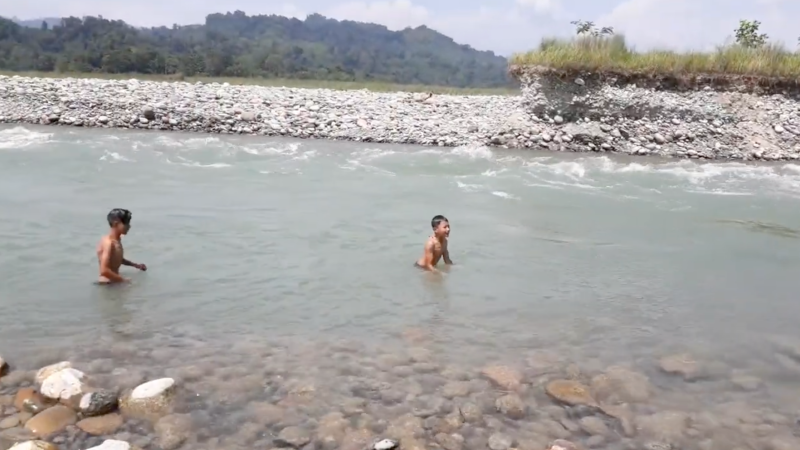
The banks of the Namdang River near Margherita offer several serene, natural spots favored by locals.
Most activity is concentrated where the river flows through the sprawling tea estates or near its confluence with the larger Dehing River.
Popular Riverbank Spots
The Namdang River is a tributary of the Dehing, and the areas where these waters meet or pass through the hills are the most scenic for a day outing.
Namdang Peace Point Path This is a favored local spot within the tea estate area, known for its quiet, verdant surroundings.
Located within the picturesque Namdang Tea Estate.
Offers a tranquil atmosphere away from the main town’s bustle.
Ideal for a quiet, self-catered picnic amidst the tea bushes and river views.
Margherita Sunset Points Situated near the major river crossings, this area provides a wide, scenic bank where the Dehing and its tributaries create a beautiful landscape.
Features expansive views of the river and the distant Patkai hills.
The area near the Margherita Dehing Bridge is a popular gathering spot for evening picnics and sunset watching.
Accessible directly from the main road, making it convenient for quick trips.
Nearby Alternatives for a Full Picnic Setup
If you are looking for more organized picnic grounds with better facilities (like water access or shade), this spot just outside the immediate Namdang area is highly recommended:
Dilli Ghat Picnic Spot This is one of the most famous riverside destinations in the region, known for its rocky banks and clear water.
Features a large area suitable for big groups and traditional “picnic cooking.”
Provides a more rugged, natural “jungle-meet-river” vibe.
Extremely popular during the winter months (December–January).
Essential Travel Tips
Carry Your Own Supplies: Most spots along the Namdang River are “wild” or within tea estates. You will need to bring your own food, water, and waste bags, as there are no commercial vendors on the banks.
Estate Permissions: Parts of the river flow through private tea estate land. If you plan to settle deep within the garden paths, it is polite to check with the local estate office or staff.
Best Time: The winter season (October to February) is best, as the water level is lower, exposing clean sand and pebble banks that are perfect for sitting.
Eco-Responsibility: As these are pristine natural areas, it is vital to pack out all trash and avoid polluting the water source.
45. Borhill Picnic Spot
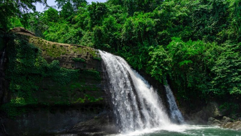
The hidden gem in West Karbi Anglong, known for its crystal-clear rocky streams and proximity to the Meghalaya border.
Borhill is a rugged, high-altitude escape where the landscape shifts from the plains of Assam into the dramatic limestone and sandstone formations of the Karbi Hills and the Jaintia Hills of Meghalaya.
Why It’s a Top Adventure Spot
The Rocky Stream: Unlike the muddy rivers of the plains, the water here is exceptionally clear, flowing over massive boulders and smooth river stones. It’s perfect for a refreshing (and chilly!) dip.
Trekking Terrain: The area around Borhill and Amri offers excellent trails for those who enjoy light trekking through dense sub-tropical forests and bamboo groves.
Untouched Beauty: Because it is relatively remote and sits on the border, it hasn’t seen heavy commercialization. It offers a raw “middle-of-nowhere” vibe that is hard to find.
Cross-Border Vibes: You’ll notice a beautiful blend of Karbi and Jaintia cultures in the local villages, from the architecture of the houses to the local food.
How to Reach
The Route: The gateway to this area is Amri. From Guwahati, you typically head toward Jagiroad and then take the interior road leading up into the hills toward the West Karbi Anglong border.
Travel Time: From Guwahati, it takes approximately 3 to 4 hours depending on road conditions. The climb involves winding hill roads with spectacular views.
Transportation: A vehicle with high ground clearance (SUV) is strongly recommended. The roads can be narrow and rocky, especially as you get closer to the stream.
Essential Travel Tips
The Best Season: November to February is ideal for crystal-clear water and cool hiking weather. Avoid the peak monsoon (June–August) as the stream can turn into a dangerous torrent and the hill roads become prone to landslides.
Safety: Since this is a border area and quite remote, it is best to travel in a group and aim to start your return journey by 3:30 PM or 4:00 PM to ensure you are back on the main roads before dark.
Logistics: There are no restaurants or formal shops at the stream. Carry everything you need: food, water, a first-aid kit, and extra clothes.
Connectivity: Expect very poor to no mobile network once you move deep into the Amri/Borhill interior. Download your maps for offline use before you leave Guwahati or Jagiroad.
46. Singlo Saheb Khana Waterfall
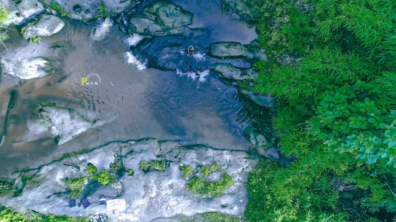
Located in the Charaideo district near Sonari, the Singlo Saheb Khana Waterfall is a hidden natural treasure tucked within the sprawling emerald slopes of the Singlo Tea Estate.
Also known as Singlo Waterfall 1, this spot is a serene getaway that combines a scenic drive through tea gardens with the refreshing sight of a forest cascade.
Why It’s a Top Hidden Gem
The appeal of Singlo Saheb Khana lies in its secluded location and the adventurous journey required to reach it.
The Tea Garden Setting: The drive to the waterfall takes you deep into the Singlo Tea Estate, offering panoramic views of undulating green hills and colonial-era tea bungalow aesthetics.
Secluded Cascade: This is a gentler, more intimate waterfall that plunges into a rocky pool, making it a favorite for photography and quiet contemplation.
Youthful Vibe: It is particularly popular among young locals and adventure seekers who visit on weekends for short road trips and nature photography.
Birding and Nature: The surrounding forest fringes are home to various local bird species, adding a natural soundtrack to the peaceful environment.
How to Get There
Route: From Sivasagar or Sonari, you head toward the Suffry area. The waterfall is located within the interior roads of the Singlo Tea Estate, near the Assam-Nagaland border.
Travel Time: From Sivasagar town, it typically takes about 1.5 to 2 hours by road.
Transportation: A motorcycle or a car with good ground clearance is highly recommended, as the final stretch involves traveling on tea garden paths and potentially some unpaved sections.
Essential Travel Tips
The Best Season: Visit between October and March for the best weather. While the waterfall is more voluminous during the monsoon, the tea garden roads can become slippery and leeches are common.
Timings: Aim to leave the area by 4:00 PM to ensure you are out of the interior garden roads before dark.
Self-Sufficiency: This is a raw, non-commercialized spot. There are no proper shops or eateries at the waterfall itself; carry your own water, snacks, and trash bags.
Safety: Wear sturdy footwear with good grip, as the rocks around the waterfall can be very slippery.
47. Hatimura Temple Hill
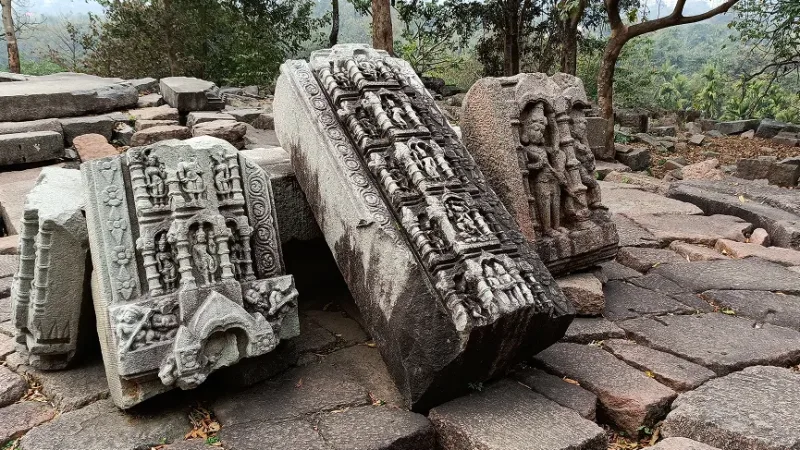
Perched on a scenic hillock overlooking the Brahmaputra River in the Nagaon district, Hatimura Temple is an 18th-century archaeological and spiritual landmark.
Commissioned during the reign of Ahom King Pramatta Singha in 1745 AD, the temple is dedicated to Goddess Durga (specifically the Mahisamardini form) and is renowned for its unique blend of Ahom architecture and ancient stone carvings.
Why It’s a Top Scenic Spot
The temple is located at a point where the river and the hills create a dramatic natural landscape, making it as much a nature retreat as a pilgrimage site.
Architectural Heritage: The temple houses a magnificent stone idol of the ten-armed Goddess Durga slaying the buffalo demon, considered a masterpiece of medieval Assamese sculpture.
Brahmaputra Views: Since the temple is situated on a high embankment, visitors can enjoy sweeping, panoramic views of the Brahmaputra River, which are especially beautiful during the golden hour.
Ancient Rock Carvings: The surrounding hillside is dotted with ancient rock-cut figures and ruins that predate the Ahom structure, suggesting the site was a center of Shakta worship for centuries.
Serene Atmosphere: Unlike the more crowded temples in larger cities, Hatimura offers a tranquil environment surrounded by local flora and the sound of the river.
How to Get There
Route: From Guwahati, follow NH 27 toward Nagaon and then take the road toward Silghat. The temple is located about 35 km from Nagaon town and roughly 5 km from the Silghat river port.
Travel Time: The 165 km journey from Guwahati takes approximately 3.5 to 4.5 hours.
Transportation: A private car is the most convenient way to reach the hill. While there is a road leading toward the base, be prepared for a short climb up the stone stairs to reach the main sanctum.
Essential Travel Tips
Best Time to Visit: The winter months from October to March offer the most pleasant weather. For a cultural experience, visit during Durga Puja, when the temple becomes a vibrant center of local festivities.
Photography: The viewpoint behind the temple offers some of the best landscape photography opportunities in Central Assam, especially as the sun sets over the river.
Facilities: There are limited facilities at the immediate temple site. It is advisable to carry your own drinking water, though small tea stalls can be found in the nearby Silghat area.
Nearby Attractions: You can easily combine this visit with a trip to the Kaliabor Tea Gardens or the Silghat Brahmaputra Viewpoint.
48. Laokhowa Wildlife Sanctuary
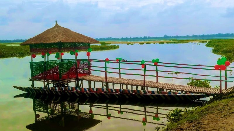
Located in the Nagaon district on the southern bank of the Brahmaputra River, the Laokhowa Wildlife Sanctuary is a vital part of the Laokhowa-Burachapori ecosystem.
This 70-square-kilometer sanctuary acts as a natural corridor between Kaziranga National Park to the east and Orang National Park to the west, making it a critical landscape for the movement of Great Indian One-horned Rhinos and Royal Bengal Tigers.
Why It’s a Key Wildlife Destination
Laokhowa is characterized by its unique “riverine” topography, consisting of vast grasslands, numerous wetlands (beels), and alluvial forests.
The Rhino Connection: Historically famous for its high rhino density, the sanctuary is currently part of major rhino reintroduction and conservation programs.
Birdwatcher’s Paradise: The sanctuary is dotted with over 20 wetlands, such as the Roumari Beel, which attract thousands of migratory birds during winter, including Lesser Adjutant Storks, Ferruginous Ducks, and Grey-headed Fish Eagles.
Diverse Fauna: While it is a tiger and rhino habitat, you can also spot Wild Water Buffaloes, Hog Deer, Wild Boars, and Leopard Cats. The riverine sections are also home to the endangered Ganges River Dolphin.
Off-the-Beaten-Path: Unlike the crowded tracks of Kaziranga, Laokhowa offers a much quieter, more raw wilderness experience, making it ideal for serious naturalists and photographers.
How to Get There
Route: The sanctuary is located about 25 km from Nagaon town. From Guwahati, follow NH 27 to Nagaon and then take the local road heading north toward the Brahmaputra.
Travel Time: The drive from Nagaon town takes approximately 45 minutes to 1 hour. From Guwahati (145 km away), the total travel time is roughly 3.5 to 4 hours.
Transportation: Private taxis or personal vehicles are the best way to reach the sanctuary entrance. The nearest major railway station is Nagaon, though many travelers use the well-connected Guwahati station.
Essential Travel Tips
Best Season: The sanctuary is best visited between November and March. During the monsoon (June–September), much of the area becomes flooded and inaccessible as the Brahmaputra overflows.
Safari Options: Jeep safaris are the primary way to explore the interior tracks. It is advisable to coordinate with the forest office at the entrance or pre-book through local eco-tourism operators.
Permits: Entry permits are required and can be obtained at the forest range office at the sanctuary gate. Ensure you arrive early (around 7:00 AM) to maximize your chances of wildlife sightings.
Connectivity: Mobile network is available near the entrance but can be inconsistent once you move deep into the grassland and wetland areas.
Nearby Stays: There are a few eco-camps and forest guest houses nearby. For more comfortable options, most visitors stay in Nagaon town.
49. Orang National Park
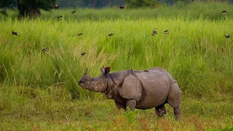
Orang National Park is often referred to as the “Mini Kaziranga.” It si located on the northern bank of the Brahmaputra River in the Udalguri and Darrang districts.
It shares a remarkably similar landscape of marshes, streams, and tall elephant grasslands, making it a critical stronghold for the Great Indian One-horned Rhinoceros.
Why It’s a Unique Wildlife Spot
Orang offers a more intimate and quiet wildlife experience compared to its larger, more famous neighbors.
Rhino Conservation: It is one of the most important habitats for rhinos in Assam outside of Kaziranga, with a very high density of the species within its 79-square-kilometer area.
Tiger Density: The park is known for having one of the highest densities of Royal Bengal Tigers in the region, though they remain elusive in the tall grass.
The Bengal Florican: Orang is one of the few remaining places where you can spot the critically endangered Bengal Florican, a rare and beautiful grassland bird.
Riverine Neighbors: Because it sits right on the Brahmaputra, the southern boundary of the park is an excellent place to catch a glimpse of the endangered Ganges River Dolphin in the river channels.
How to Get There
Route: From Guwahati, follow NH 15 toward Mangaldai and continue toward Silbori. The park is approximately 140 km from Guwahati.
Travel Time: The drive typically takes between 3.5 to 4.5 hours.
Transportation: Private taxis or personal vehicles are the most convenient options. The nearest major town is Mangaldai (approx. 32 km away), which is well-connected by bus and local transport.
Essential Travel Tips
Best Season: The park is officially open from November to April. Like most parks in Assam, it remains closed during the monsoon season (usually from June to September) due to heavy flooding from the Brahmaputra.
Safari Options: Jeep safaris are the primary way to explore the interior. Aim for the early morning slot (7:00 AM) or the afternoon slot (2:00 PM) for the best wildlife activity.
Permits: Entry permits must be obtained at the forest range office at the main gate.
Peace and Quiet: One of Orang’s biggest draws is the lack of tourist crowds. It is perfect for serious photographers and nature lovers who prefer a solitary experience.
Connectivity: Mobile signal is generally available near the forest range office but can be spotty once you are deep inside the grasslands.
50. Mou Chapori
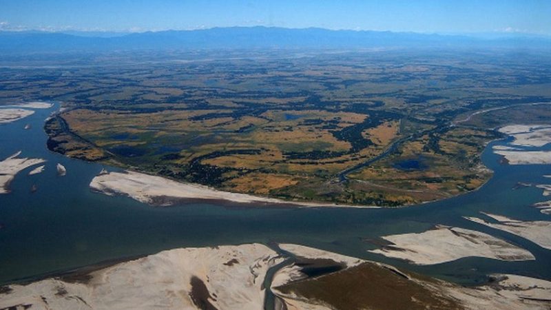
Mou Chapori is a seasonal river island (sandbar) located in the Brahmaputra River, approximately 13 km from Jorhat.
Famous for its expansive stretches of sparkling white sand, it emerges during the dry winter months, creating a desert-like landscape in the middle of the river. It is a premier destination for those seeking a “castaway” experience near the gateway to Majuli.
Why It’s a Top Scenic Spot
The “White Desert” of Assam: As the river recedes, it leaves behind vast, silt-rich white sands. Against the deep blue of the Brahmaputra, this creates a stunning visual contrast that is a favorite for landscape photographers.
Winter Picnic & Camping: Its proximity to Jorhat makes it a popular hub for day-trip picnics and overnight “sandbar camping.” The lack of light pollution provides some of the clearest night skies in Upper Assam for stargazing.
Migratory Bird Sanctuary: From November to February, the secluded banks become a resting ground for thousands of migratory birds, including Siberian Cranes and Ruddy Shelducks.
Panoramic Horizons: Being a flat island, it offers 360-degree unobstructed views, making it one of the best spots in the region to witness both sunrise and sunset over the water.
How to Reach
Route: From Jorhat town, travel approximately 13 km toward the Nimati Ghat area.
The Boat Trip: Since it is an island, you must hire a local “country boat” (known as a bhut-bhuti) or a small manual boat from the riverbank.
Travel Time: The boat ride typically takes 15 to 30 minutes, depending on the river’s current and the shifting position of the sandbar that year.
Essential Travel Tips
Seasonality: This spot is only accessible in winter (late October to early March). By April, the rising water levels of the Brahmaputra begin to submerge the white sands.
Sun Protection: There is zero natural shade on the chapori. The sun reflects intensely off the white sand, so carrying an umbrella, hat, and sunscreen is essential.
Footwear: Wear sandals or flip-flops, as you will likely need to step into shallow water when boarding or deboarding the boat.
Self-Sufficiency: There are no permanent shops, toilets, or structures on the island. You must carry all your own food, water, and supplies.
Eco-Responsibility: Because the river reclaims this land every year, it is vital to pack out all trash to prevent plastic from entering the Brahmaputra ecosystem.
Final Thoughts
Assam is a land of endless exploration, and each of these locations offers a unique way to connect with the state’s natural heritage. Whether you prefer the historic charm of Sivasagar or the rugged riverbanks of Bogamati, finding the perfect picnic place in Assam is the best way to celebrate the winter season.
From the Brahmaputra’s sandbanks to the hidden waterfalls of Karbi Anglong, these 50 picnic spots in Assam showcase why this state is a top destination for nature lovers.
Pack your bags, carry your own trash bags to keep the areas clean, and enjoy the incredible beauty Assam has to offer.
Love Assam? Wear an Assamese T-shirt!

Matile Ronoloiu Jaba Namatile Bhujoloiu Najaba
Rated 5.00 out of 5

Moi Polua Nai Lukai He Asilu
Rated 5.00 out of 5

Aami Jen Jontro
Rated 4.71 out of 5

Gh#### Kaku Khatir Nokoru
Rated 4.86 out of 5
More Blog Posts You Might Like...